
{“content”: “
FOUND: True
nCOUNT: 1
n{“content”: “
n
MATCH FOUND
n
n
The Middle East briefing 3,000+ readers start their day with.
One email. Every weekday morning. Free.
n
TEHRAN u2014 Iran’s Islamic Revolutionary Guard Corps published a navigational chart on April 9 marking the Strait of Hormuz’s internationally established shipping lanes as a “danger zone” and redirecting all commercial traffic to a 5-nautical-mile corridor near Larak Island u2014 the first public confirmation that mines laid during the 40-day war remain in place, and that ceasefire-era access to the world’s most important oil chokepoint now runs through an IRGC permission system. The chart, distributed by IRGC-linked news agencies ISNA and Tasnim and dated from February 28 through April 9, appeared the same morning Iran’s diplomatic delegation landed in Islamabad for bilateral talks built around a 10-point plan whose seventh provision demands permanent IRGC “coordination” over Hormuz transit u2014 converting what was supposed to be a wartime emergency into a negotiating position that could outlast the ceasefire itself.
n
n
n
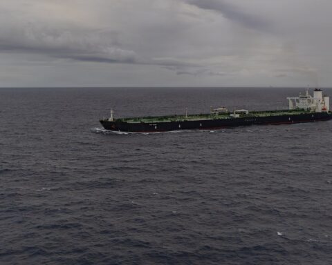
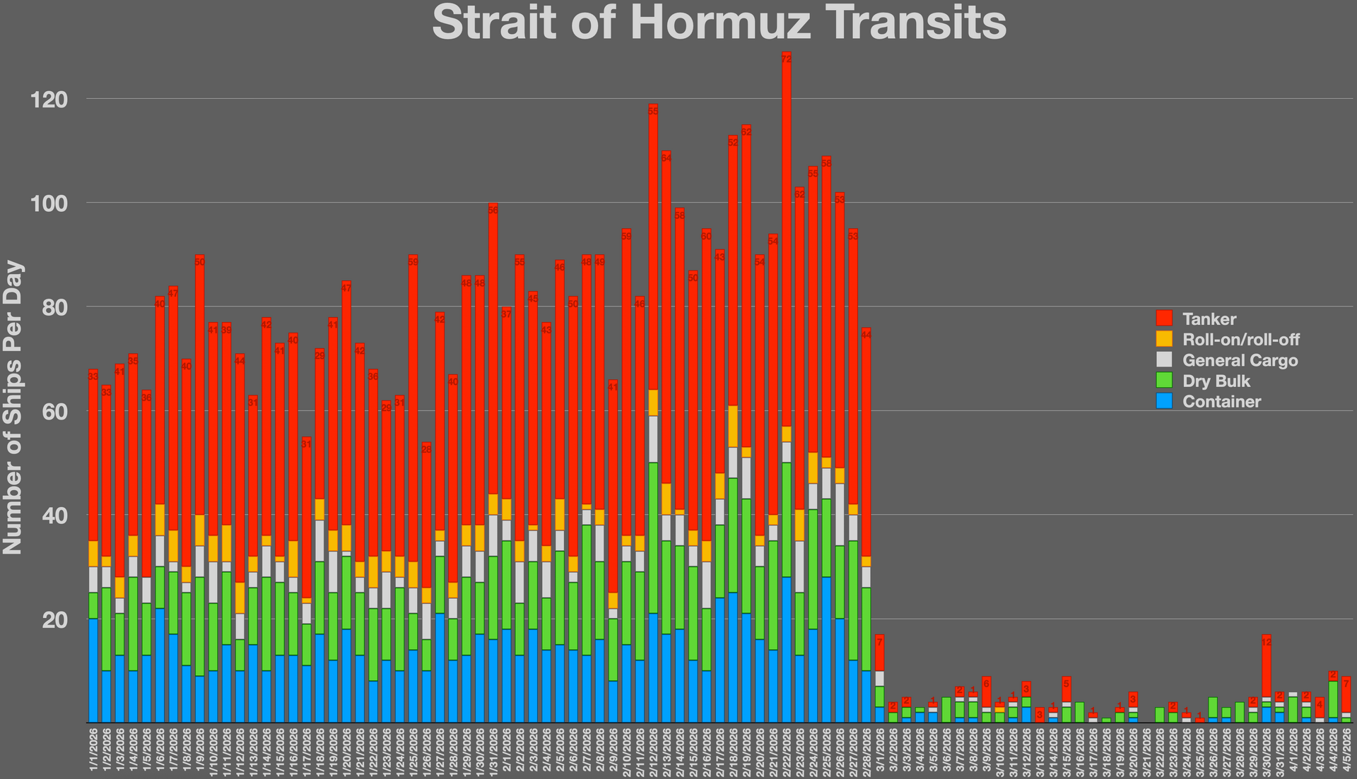
Only four vessels with active transponders crossed the strait on April 9, according to AP wire data, against a pre-war baseline of 138 commercial ships per day. Behind them, 426 tankers, 34 LPG carriers, and 19 LNG vessels sit in a backlog that stretches from the Gulf of Oman to the South China Sea, and every one of them now knows exactly what “open” means in the IRGC’s vocabulary: open to whoever the Guards permit, via the route the Guards control, at a price the Guards set.
n
n
n
n
Table of Contents
n
n
n
- n
- What the Chart Shows u2014 and What It Admits
- The Larak Corridor: Five Miles Wide, All of It Iranian
- Why Won’t Ships Move?
- Can Anyone Clear the Mines?
- The San Remo Loophole Iran Is Living Inside
- The Islamabad Connection
- What “Open” Means Now
n
- n
n
n
n
n
n
n
n
n
n
n
n
n
n
n
n
n
n
n
n
n
n
n
n
n
n
n
n
n
n
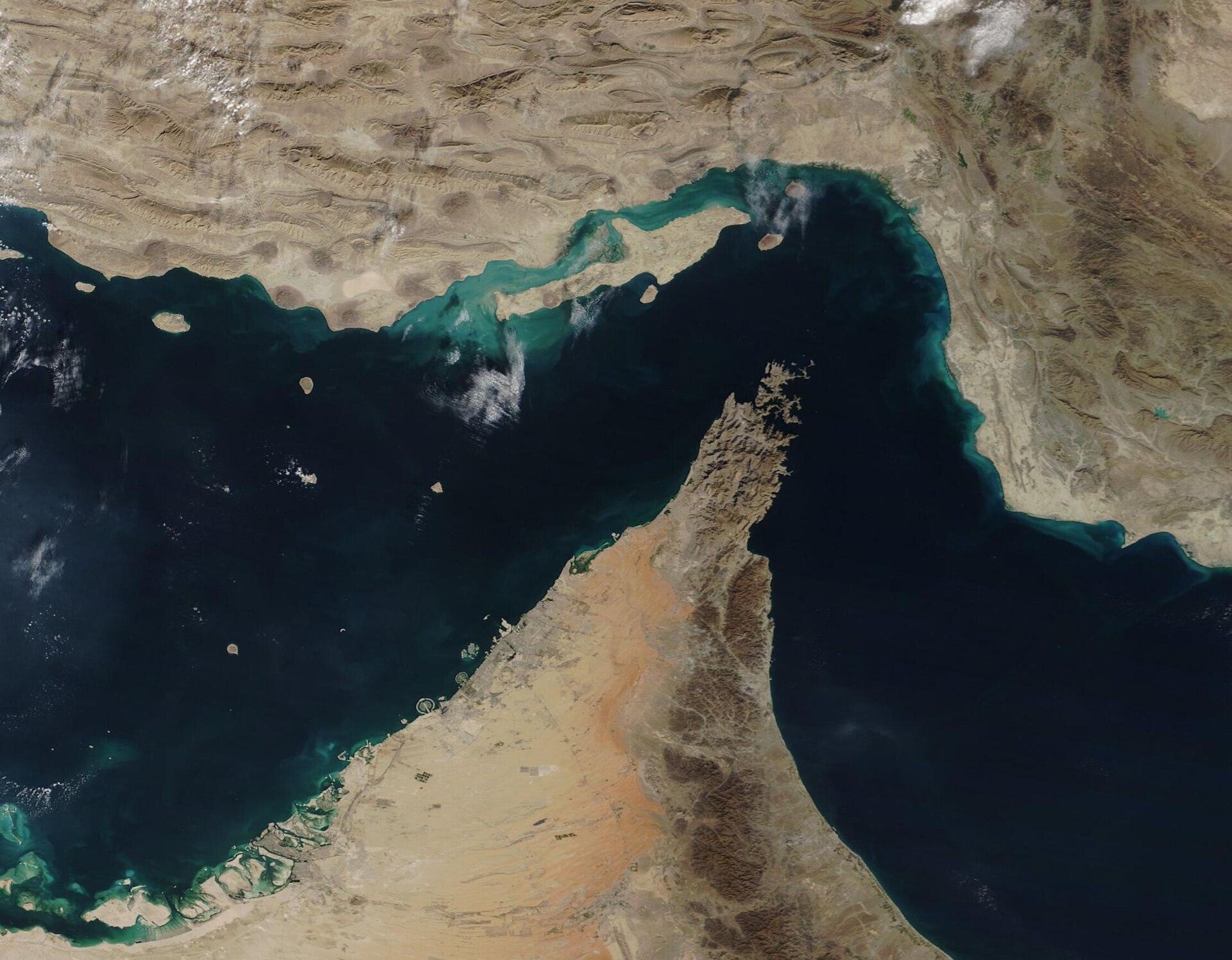
What the Chart Shows u2014 and What It Admits
n
n
n
The chart circulated by ISNA on the morning of April 9 is not a formal IRGC communique, and that ambiguity is the point. It shows a large circle marked “danger zone” in Farsi overlaying the Traffic Separation Scheme u2014 the two 2-mile-wide shipping lanes that have governed Hormuz transit since the International Maritime Organization established them decades ago u2014 and warns of “various types of anti-ship mines,” according to the Jerusalem Post’s translation. The dating is telling: February 28 through April 9, spanning the entire conflict from the first Iranian strikes through the second day of the ceasefire, with no indication that any mines have been swept or that the danger zone’s boundaries will shrink.
n
n
n
Iran began laying mines on March 10, according to CNN reporting at the time, starting with “a few dozen” while retaining what intelligence analysts estimated was 80 to 90 percent of its small-boat and minelaying fleet. The International Institute for Strategic Studies assessed Iran’s total mine inventory at 5,000 to 6,000 u2014 of which roughly 12 have been confirmed in the strait and 16 Iranian minelaying vessels were sunk by US forces through mid-March, as IISS senior fellow Nick Childs told NPR. The chart does not specify how many mines remain, but the IRGC’s accompanying statement, reported by the Sunday Guardian Live, was explicit: ships without authorization would be “targeted and destroyed,” and the strait would “never return to its previous status.”
n
n
n
That last phrase carries more weight than any mine. Mines can be cleared u2014 eventually, with assets that do not currently exist in the theater. A political declaration that the strait’s pre-war operating norms are permanently dead is a different category of obstacle, and the chart published on April 9 is the IRGC’s way of putting it on paper without putting an official seal on it.
n
n
n
n
n
n
The Larak Corridor: Five Miles Wide, All of It Iranian
n
n
n
The alternative route the chart prescribes runs through the Qeshm-Larak channel: inbound ships travel north of Larak Island, outbound ships pass south of it, through a passage that narrows to approximately 5 nautical miles at its tightest point u2014 roughly one-quarter the width of the main strait’s established lanes, as the Maritime Executive reported on April 9. The corridor sits entirely within Iranian territorial waters, with an IRGC naval base on Qeshm’s southern shore providing both surveillance and, when the Guards choose, escort vessels.
n
n
n
The permission framework that governs this corridor was documented by Al Jazeera on March 26 and has not changed since the ceasefire: vessels must submit their IMO identification number, complete cargo manifest, full crew roster with names, ownership structure, and final destination to IRGC-linked intermediaries, followed by a VHF-broadcast route code that functions as a transit license. IRGC commanders verify on approach and dispatch pilot boats. The fee is $2 million per vessel, paid through Chinese yuan intermediaries u2014 a sum that Iranian lawmaker Alaeddin Boroujerdi defended on state media as a sovereign right: “We must do this and take transit fees from ships passing through the Strait of Hormuz.”
n
n
n
The countries whose vessels have been permitted IRGC-approved passage u2014 China, India, Russia, Pakistan, Iraq, Malaysia, Egypt, and South Korea u2014 form a list that tracks closely with Iran’s diplomatic and economic dependencies, not with any principle of open navigation. Within 24 hours of the ceasefire announcement on April 8, only seven ships transited the strait, six of them Chinese- or Greek-owned bulk carriers using the IRGC’s coastal route rather than the main Traffic Separation Scheme, according to RNZ citing MarineTraffic data. Against a pre-war baseline of 138 vessels per day, as previously reported, ceasefire-day throughput ran at roughly 5 percent of normal capacity. Goldman Sachs had cut its Q2 Brent forecast to $90 that same day on the assumption that LNG flows through Hormuz would begin normalising from mid-April u2014 the IRGCu2019s permission-based corridor made that normalisation timeline structurally impossible.
n
n
n
Why Won’t Ships Move?
n
n
n
The backlog numbers tell only half the story. Dimitris Ampatzidis, a senior risk analyst at Kpler, told 19FortyFive on April 9 that there were “no clear signs yet of large-scale positioning or queuing that would indicate ships are preparing to move through in significant numbers,” adding that “most operators appear to be holding back.” June Goh, an analyst at Sparta Commodities, told RNZ the same day that whether “vessels willing to go back inside the Strait of Hormuz” remained uncertain despite the theoretical reopening u2014 a formulation that captures the gap between a ceasefire text and a navigable waterway.
n
n
n
Angela Gillham, CEO of Maritime Industry Australia, was more direct in her assessment to RNZ: “I think there’s a very low appetite” for risking crew lives transiting an active conflict zone. War risk insurance premiums explain part of that appetite u2014 Lloyd’s List reported they had risen from 0.2 to 0.25 percent of hull value before the war to 2.5 to 7.5 percent by mid-March, with US-, UK-, and Israeli-nexus vessels facing surcharges up to 10 percent. For a VLCC valued at $138 million, that translates to a premium of $10 million to $14 million per voyage, and the all-in cost of a single tanker transit u2014 combining insurance, IRGC tolls, and risk pricing u2014 now potentially reaches $7 million per crossing, according to RNZ’s April 9 reporting. The insurance constraint became the operative enforcement mechanism by April 18, when two dozen ships turned back at Hormuz after P&I clubs and Lloyd’s underwriters withdrew war risk cover — the de facto blockade enforced by the market, not by navies.
n
n
n
But the insurance math is downstream of a simpler problem, one that Nick Childs at IISS framed with precision: “Mines have two warheads. One is a high-explosive warhead, and the other one is a psychological one. Just the threat and thought of the possibility that there might be a mining threat may be enough to maintain that stranglehold.” The IRGC’s chart is the psychological warhead, detonated publicly, and it does not need to specify whether there are 12 mines or 120 in the marked zone u2014 the ambiguity is the weapon, and the 3,200 ships and 20,000 seafarers trapped in Gulf waters are its hostages.
n
n
n
n
n
n
Can Anyone Clear the Mines?
n
n
n
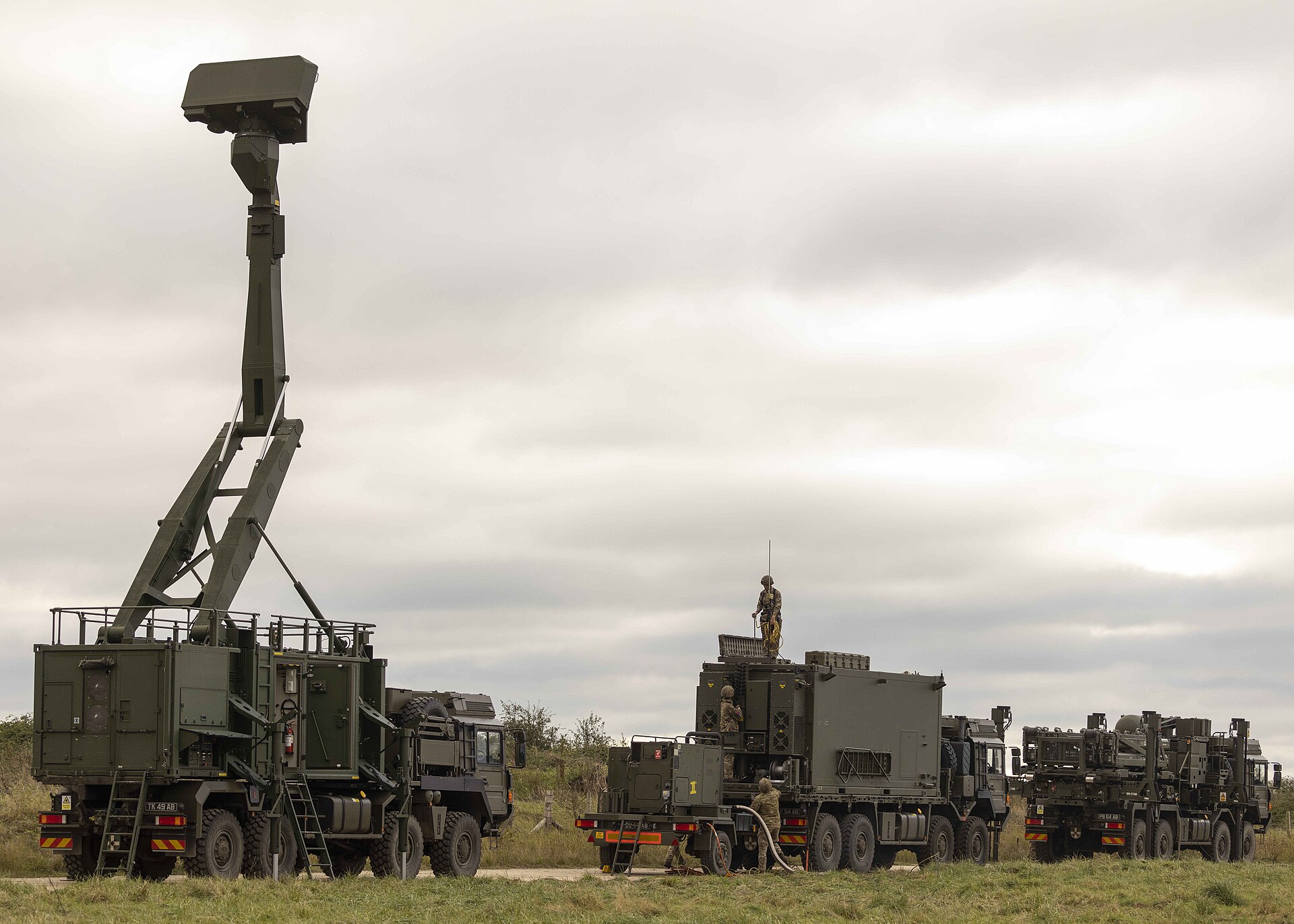
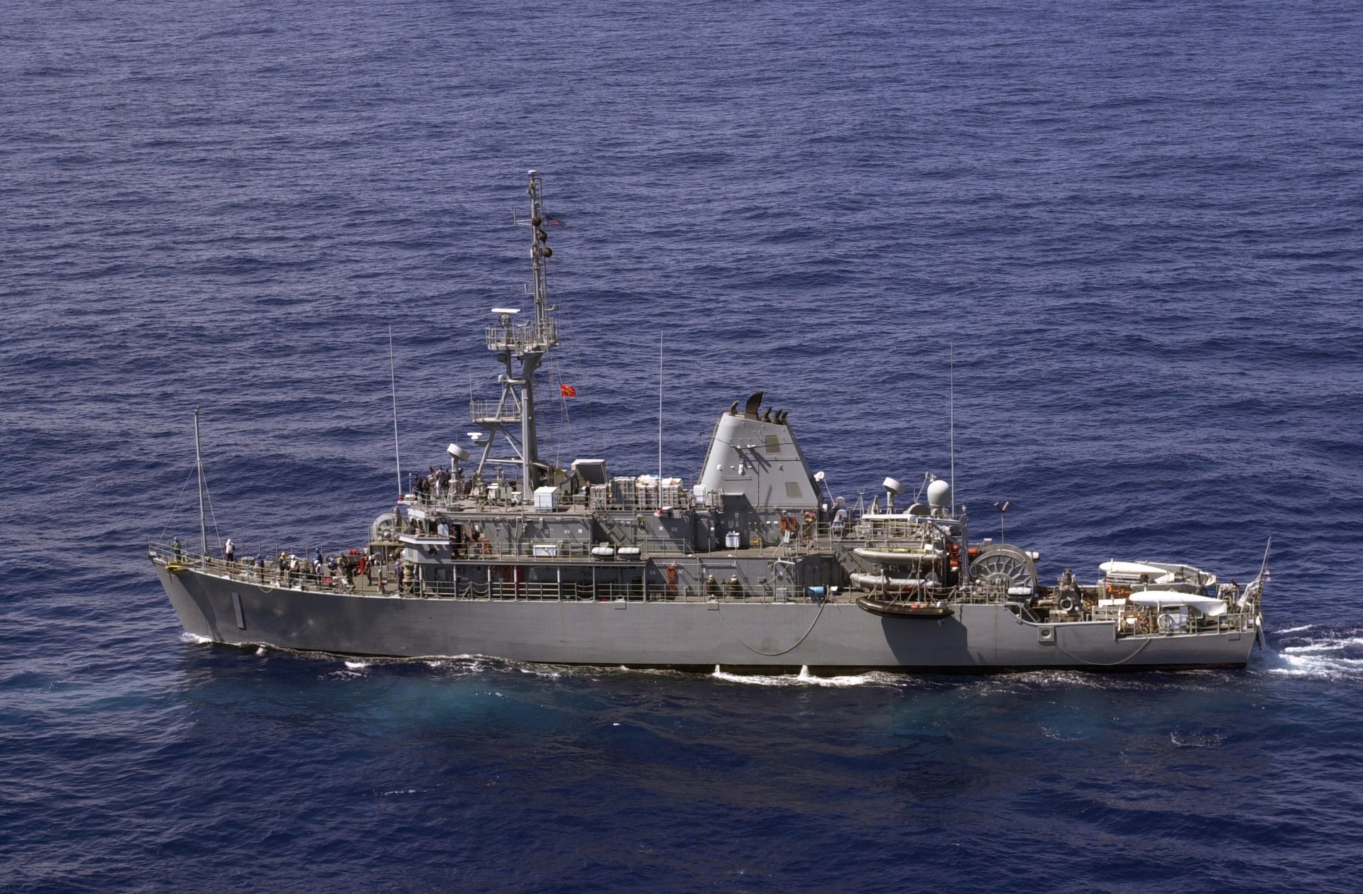
The physical reality beneath the chart is worse than the chart implies. Clearing the full Traffic Separation Scheme requires sweeping approximately 200 square miles of seabed, and the assets to do it are not in place. The US Navy retired its last four forward-deployed Avenger-class mine countermeasure ships from Bahrain on September 25, 2025 u2014 five months before the war began u2014 and the three Littoral Combat Ships equipped with MCM mission packages are partially deployed to Asia, available only approximately 30 percent of operational time according to Pentagon performance data reported by the Christian Science Monitor on March 20. The Washington Institute assessed that clearing Hormuz would require up to 16 MCM vessels; the Navy has seven in its entire fleet. CENTCOM formally activated the declared US mine-clearance mission on April 11, sending USS Frank E. Petersen Jr. and USS Michael Murphy through the strait u2014 the first direct operational challenge to the IRGC danger-zone chart.
n
That MCM gap is now being addressed: USS Pioneer (MCM-9) and USS Chief (MCM-14) are transiting to close that mine-clearance gap, with arrival expected between April 22 and April 27 u2014 the first dedicated Avenger-class mine countermeasures ships to enter the region since the Bahrain decommissions. How many ships the Navy has, what the LCS mine-countermeasures equipment actually achieves in the water, and the mine-clearance timeline that determines when Saudi Arabia’s oil exports recover is examined here.
n
n
n
Emma Salisbury, a senior fellow at the Foreign Policy Research Institute, told NPR on April 1 that she was “honestly completely baffled” by the absence of US mine countermeasure resources from the region. Sea mines have sunk or crippled 15 US Navy vessels since World War II, more than all other weapons combined, according to NPR’s reporting. Retired Admiral James Foggo, dean of the Center for Maritime Strategy, told the same outlet that mine clearing would take “at least a month” to get underway if started immediately, and the 1991 Kuwait benchmark offers the only modern comparison: 51 days to clear 907 mines, with Iraqi cooperation and maps that identified every mine’s location. The April 17 Paris summit’s mine-clearance mandate depends on the same MCM asset gap detailed here: Forty Nations Came to Paris for Hormuz. None Can Open It. examines why the coalition cannot begin clearance operations regardless of political will.
n
n
n
No such maps exist for Hormuz. The IRGC’s chart marks where the danger is, not where individual mines sit, and Iran has offered no cooperation on clearance u2014 because the mines are not a problem Iran wants solved. European minesweepers are “months away,” and American assets would need “a significant number of weeks” even to begin effective operations, according to the Columbia University Center on Global Energy Policy. The strait that carried 20 percent of the world’s oil before February 28 is now a minefield with a bypass lane, and the bypass runs through the IRGC’s front yard. The problem runs deeper still: U.S. officials have disclosed that Iran cannot reliably locate all of the mines it planted, meaning the physical barrier to reopening is not merely political u2014 it is one Iran itself cannot fully undo.
n
n
n
The San Remo Loophole Iran Is Living Inside
n
n
n
International law on mine warfare in straits hinges on the San Remo Manual on International Law Applicable to Armed Conflicts at Sea, the 1994 framework that most naval powers treat as customary law. The manual requires mine-laying states to provide “safe alternative routes for shipping of neutral States” u2014 and Iran’s Larak corridor technically satisfies this requirement. The mines are marked, the alternative route is published, and vessels are being escorted through it. The legal compliance is formal and the practical effect is total control.
n
n
n
Michael Schmitt and Rob McLaughlin, professors of international law writing in Just Security, argued that “mines may not be used in a manner that effectively prevents or suspends transit passage for neutral vessels through international straits like the Strait of Hormuz,” and that transit passage “cannot be hampered even during armed conflict.” James Kraska, chair of the Stockton Center for International Law at the US Naval War College, told CNN that “imposing transit fees is a violation of the rules of transit passage” and that Hormuz, as an international strait, carries a right of transit passage “for all states, which permits unimpeded surface, overflight, and submerged transit.”
n
n
n
The problem is enforcement. UNCLOS Articles 38 and 44 state that transit passage “shall not be impeded,” but Iran, the United States, and Israel are all non-ratifiers of the convention u2014 removing treaty enforcement as a mechanism. The IRGC is not denying transit passage; it is rerouting it through a corridor where passage requires permission, payment, and an escort, and where the permitting authority is the same military force that laid the mines. Deputy Foreign Minister Saeed Khatibzadeh told the BBC that Iran would allow passage “in accordance with international norms and international law” once the US ends “aggression” and Israel stops attacking Lebanon u2014 linking strait access to the Lebanese theater, not just the ceasefire text, and extending the conditionality beyond anything the Islamabad framework contemplates.
n
n
n
The Islamabad Connection
n
n
n
The chart’s publication on the morning of April 9 u2014 the same day Iran’s diplomatic delegation arrived in Islamabad u2014 is not coincidental in its timing or its function. Ambassador Reza Amiri Moghadam announced on X that the “Iranian delegation arrives tonight in Islamabad for serious talks based on 10 points proposed by Iran,” and Point 7 of that plan demands Hormuz “coordination with Armed Forces of Iran.” The mine chart is the physical proof that coordination is already happening u2014 on the IRGC’s terms, through the IRGC’s corridor, at the IRGC’s price u2014 and that any negotiation over Hormuz access starts from the baseline the chart establishes, not from the pre-war norm.
n
n
n
The Atlantic Council’s Matthew Kroenig captured the structural problem in comments to NPR on March 12, weeks before the ceasefire: “As long as Iran has drones and missiles and Iran continues to fire them, I think many commercial shippers are going to think it’s just too dangerous, even with an escort.” The ceasefire has nominally stopped the firing, but the mines remain, the corridor remains, the toll remains, and the IRGC’s declaration that the strait will “never return to its previous status” has now been cartographically formalized. Ghalibaf arrived at Islamabad already holding the exit, and the mine chart is the key.
n
n
n
Saudi Arabia negotiated a ceasefire whose value depends almost entirely on Hormuz reopening u2014 the kingdom’s fiscal breakeven sits between $94 and $111 per barrel depending on whether PIF capital expenditure is included, Brent closed at approximately $97.46 on April 9, and the East-West Pipeline bypass to Yanbu covers only 3 to 4 million barrels per day of effective capacity against pre-war exports that ran above 7 million. Every day the IRGC’s permission system governs strait access instead of international shipping norms, Saudi Arabia’s fiscal position erodes further u2014 and the mine chart tells the market that those days are not ending with the ceasefire.
n
n
n
n
n
n
What “Open” Means Now
n
n
n
The USS Samuel B. Roberts struck an Iranian mine in the Strait of Hormuz on April 14, 1988, tearing a 15-foot hole in the frigate’s hull during Operation Earnest Will u2014 the Reagan-era convoy escort mission that represented the last time the US Navy tried to guarantee Hormuz transit against Iranian mining. US divers recovered mines matching serial numbers from the captured Iranian minelayer Iran Ajr, and four days later the Navy launched Operation Praying Mantis, the largest American surface engagement since World War II, destroying two oil platforms and sinking the Iranian frigate Sahand. That was 38 years ago, and the Navy had dedicated mine countermeasure ships forward-deployed in the Gulf throughout.
n
n
n
Today the dedicated MCM ships are retired, the mines are confirmed, the corridor is published, and the IRGC is charging $2 million per transit through a passage that runs inside Iranian territorial waters past an IRGC naval base. Brent crude rose 2.9 percent on April 9 as the chart circulated. The 426 tankers, 34 LPG carriers, and 19 LNG vessels in the waiting backlog must now decide whether the IRGC’s definition of “safe alternative route” is a route they are willing to take u2014 with their ships, their crews, and their $10 million to $14 million insurance premiums riding on the answer.
n
n
n
The ceasefire said the strait would be open. The IRGC’s chart, published the morning its diplomats flew to Islamabad to negotiate permanent control of that opening, defines exactly what open means: 5 nautical miles wide, flanked by an IRGC naval base, mined on both sides, and accessible only to those who submit their crew manifests, pay in yuan, and wait for the pilot boat.
n
n
n
The mine chart was followed by a broader assertion of jurisdiction: the IRGC Navy’s formal “full authority” declaration over Hormuz establishes the constitutional architecture behind the chart u2014 and explains why no diplomatic agreement signed in Islamabad can revoke it without a separate IRGC command order that has no current pathway to be issued.
n
n
n
Background
n
n
n
The Strait of Hormuz carries approximately 20 percent of the world’s oil supply and roughly one-quarter of global LNG trade, funneling traffic between the Persian Gulf and the Gulf of Oman through a passage that narrows to 21 nautical miles at its tightest point. The Traffic Separation Scheme divides this into two 2-mile-wide shipping lanes u2014 inbound and outbound u2014 separated by a 2-mile buffer zone, and has governed commercial transit since its establishment by the International Maritime Organization.
n
n
n
Iran’s war with the United States, which began with Iranian strikes on February 28, 2026, led to IRGC mine-laying operations starting March 10, followed by the imposition of a $2 million transit toll, a vessel-by-vessel permission system, and the effective closure of the standard shipping lanes. The Tanker War of 1984 to 1988 u2014 the most sustained attack on merchant shipping since World War II, which killed more than 400 civilian seamen u2014 established the precedent for Iranian mining of the strait, and the current crisis has reproduced its core dynamic: mines as both a physical barrier and a coercive instrument, with clearance timelines measured in months and political resolution measured in conditions Iran sets.
n
n
n
The ceasefire announced on April 8 did not include specific provisions for mine clearance, TSS restoration, or a timeline for ending the IRGC toll system. Iran’s 10-point plan, presented as the basis for Islamabad talks on April 9, embeds IRGC control of Hormuz transit as Point 7 u2014 framing it as a permanent arrangement rather than a wartime measure. The mine clearance timeline and its implications for Aramco’s “days to restart” production claim are examined in detail alongside Saudi Arabia’s field-level constraints.
n
n
n
FAQ
n
n
n
How long would it take to clear the mines from the standard shipping lanes?
The only modern benchmark is Kuwait in 1991: 51 days to clear 907 mines, with Iraqi cooperation and maps showing every mine’s location. No such cooperation or maps exist for Hormuz. Retired Admiral James Foggo estimated mine clearing would take “at least a month” to get underway if started immediately, and the Columbia University Center on Global Energy Policy assessed that European minesweepers are “months away” while US assets would need “a significant number of weeks.” The sweeping area covers approximately 200 square miles, and the US Navy retired its last four dedicated mine countermeasure ships from Bahrain in September 2025.
n
n
n
Why can’t the US Navy clear the mines now?
The Navy’s four Avenger-class MCM ships that were forward-deployed to Bahrain were retired on September 25, 2025. Their replacements u2014 Littoral Combat Ships with MCM mission packages u2014 are partially deployed to the western Pacific and available only about 30 percent of the time, according to Pentagon data. The Washington Institute assessed that clearing Hormuz would require up to 16 MCM vessels; the Navy has seven total. Emma Salisbury of the Foreign Policy Research Institute told NPR she was “honestly completely baffled” by the gap.
n
n
n
Is Iran’s mine chart legally binding?
The chart was published through IRGC-linked news agencies ISNA and Tasnim rather than as a formal IRGC communique, giving Tehran plausible deniability while establishing the physical reality. Under the San Remo Manual, mine-laying states must notify mariners and provide safe alternative routes u2014 and the chart serves as that notification. Whether the Larak corridor meets the “safe alternative” standard under international law is contested: legal scholars Schmitt and McLaughlin argue mines cannot effectively prevent transit passage through international straits, but enforcement mechanisms are absent because Iran, the US, and Israel are all non-ratifiers of UNCLOS.
n
n
n
What is the Islamabad 10-point plan’s position on mine clearance?
Iran’s 10-point plan makes no mention of mine clearance or a timeline for restoring the standard Traffic Separation Scheme. Point 7 demands permanent IRGC “coordination” over Hormuz transit u2014 language that embeds the current permission system as the new baseline rather than a wartime exception. Deputy FM Khatibzadeh separately conditioned normalized passage on the US ending “aggression” and Israel stopping strikes on Lebanon, linking Hormuz access to the Lebanese theater in a way that extends conditionality well beyond anything the ceasefire text addresses. The mine chart, in this context, is not an interim measure pending negotiation u2014 it is the opening position.
n
n
n
What happens to Saudi Arabia’s fiscal position if Hormuz stays restricted?
Saudi Arabia’s fiscal breakeven ranges from $94 per barrel (Bloomberg IMF central government estimate) to $111 per barrel when PIF capital expenditure is included. Brent closed at $97.46 on April 9 u2014 a buffer of $3 per barrel at best, zero at worst. The East-West Pipeline bypass to Yanbu covers only 3 to 4 million barrels per day of effective capacity against pre-war exports above 7 million, leaving a structural gap that can only be closed by Hormuz reopening on terms outside IRGC control. Aramco’s June OSP repricing window opens around May 5; every week of restricted throughput before that date widens the gap between the May OSP (+$19.50 per barrel above benchmark, set when Brent was at $109) and the market price that Asian buyers are actually paying. The force that would normally clear those mines to reopen the strait is unavailable: NATO has no mine countermeasure ships in theater, and the four dedicated MCM vessels previously based in Bahrain were decommissioned six months before the war started. On April 11, the US Navy sent two guided-missile destroyers on a round-trip transit of the strait u2014 the first American warship passage since the war began u2014 a demonstration that warships can cross the mined danger zone at speed, though the mine chart remains the operative document for deep-draft commercial vessels. The result is a split operating environment that Saudi Arabia must navigate without endorsing either track, as analysed in the dual-track Hormuz architecture. The mine chart was followed on April 10 by a broader declaration: the IRGC’s formal Hormuz access regime announced that Hormuz management had “entered a new phase,” with vessels transiting without express authorization to be targeted and destroyed. The mine types underpinning that threat have since been publicly designated: the Italian-derived Maham-7’s sonar-scattering design and the moored Maham-3 are the variants CENTCOM is now actively working to neutralise. The Hormuz mine threat has since been compounded by Iran’s formal equation of Bab el-Mandeb with Hormuz as a parallel chokepoint — collapsing the assumption that Saudi Arabia’s East-West Pipeline bypass provides meaningful export resilience, as analyzed in The Bypass Was the Hedge. Now the Hedge Is Threatened.
n
The Hormuz mine crisis has since been compounded by a new dimension of US enforcement: CENTCOM’s “regardless of location” seizure doctrine, announced April 16, extends interdiction authority beyond Iranian ports to any vessel suspected of carrying Iranian crude — including Bahri-chartered VLCCs in the Red Sea corridor that Saudi Arabia built as its mine-free alternative. How that doctrine creates a second chokepoint exposure for Yanbu’s 5-million-barrel-per-day throughput is analyzed here. The legal and operational architecture through which forty-one nations plan to clear those mines — and the Northwood military planning summit that converts the Paris political declaration into deployment orders — is examined in Paris Built a Hormuz Framework Washington Cannot Join. The corridor system the IRGC declared in that chart is now operational: on April 24, the US-sanctioned VLCC Yuri became the first major sanctioned supertanker to test the Larak passage, halting east of Larak Island with two million barrels of Iranian crude while Witkoff and Kushner flew to Islamabad. The Yuri halt, its OFAC exposure, and what it confirms about the corridor’s enforcement architecture are detailed here.
n
n”}
n
The ceasefire did not halt IRGC mine-laying activity: subsequent analysis of mine density and GPS-guided variant deployment places full Hormuz clearance at six months from any ceasefire agreement, under Pentagon best-case assumptions. How that timeline interacts with the diplomatic calendaru00e2u0080u0094and why the Northwood planning summit cannot compress itu00e2u0080u0094is examined in Iranu00e2u0080u0099s Ceasefire Mines Will Keep Hormuz Closed Until Winter. The deeper structural reason that timeline cannot compress u2014 IRGC Navy’s headless command structure since Tangsiri’s death, and what it means for mine-position records u2014 is the subject of Iran’s mine warfare command vacuum. The political dimension of that timeline u2014 why Hegseth called the Pentagonu2019s own assessment an u201cimpossibilityu201d then declined to replace it u2014 is examined in Hegseth Called His Own Pentagonu2019s Mine Clearance Assessment an Impossibility.
n
The post-ceasefire mine deployment that undermines those clearance assumptions — IRGC Navy continuing to lay mines after the April 23 ceasefire, Iran’s inability to locate mines placed without a master chart, and why the six-month clearance timeline cannot compress even under the Washington Institute’s best-case 16-vessel scenario — is examined in Iran Cannot Find Its Own Hormuz Mines — and the US Has No Ships to Clear Them.
n
The intelligence picture has since deteriorated further. A subsequent analysis examines Iran’s inability to locate the mines it laid — a failure of mine-record discipline that makes every proposed reopening timeline structurally undeliverable from Tehran’s side.
n
The political threshold for translating that timeline into a diplomatic claim arrived on May 14, when CENTCOM commander Admiral Brad Cooper told the Senate Armed Services Committee that American forces had destroyed more than 90 percent of Iran’s 8,000-mine inventory — a figure that simultaneously validates the scale of IRGC mine-laying documented here and raises the question of what percentage constitutes commercial navigability. The answer — and why Aramco’s own CEO set mid-June as the market’s last normalization window — is examined in Cooper Says 90 Percent of Iran’s Mines Destroyed. The Strait Remains Closed.
n”}