
Saudi Arabia has spent decades building a reputation as a place of pilgrimage, petroleum, and desert sun. What that shorthand misses is an entire vertical world: a mountain arc running the length of the country’s western edge, dissected by canyons that drain toward the Red Sea, and studded with ancient trails worn smooth by frankincense merchants and pilgrims long before any modern path-marker existed. If you want a comprehensive overview of the country’s outdoor landscape, the Saudi Arabia Hiking Guide covers the full spectrum — but this guide goes deep into specific trails, graded by difficulty, measured in kilometres and vertical metres, and organised by region so you can plan a trip that matches your fitness and schedule.
Best Regions: Asir, AlUla, Tabuk, Hail, Al Baha
Best Season: October–March
Visa Required: Yes — tourist e-visa
Top Trail: Al Soudah Peak hike (3,015m, Asir)
Difficulty Range: Easy day walks to multi-day treks
Avoid: Unmarked trails without GPS/guide
The kingdom stretches 2,150 kilometres from north to south. At its southwestern corner, the Asir and Al Baha highlands receive more rain than anywhere else in Saudi Arabia — enough to sustain juniper forests, hanging gardens in terraced valleys, and populations of hamadryas baboons that regard hiking visitors with indifferent curiosity. Move north along the Hejaz Escarpment and the landscape dries out but rises no less dramatically. Continue to Tabuk and the northwest, and the terrain shifts again: rose-coloured sandstone canyons, Nabataean rock-cut tombs, and a valley — Wadi Disah — that Bedouin called “the valley of palm trees.” Further east, in the AlUla basin, an entire national tourism programme has been built around landscape hiking, with graded trails, guided experiences, and a nature reserve that opened its first hiking routes in 2022.
What follows is a region-by-region breakdown of the best-verified, named hiking trails in the kingdom, with real distances, elevation data, difficulty grades, and seasonal guidance drawn from AllTrails data, the official Experience AlUla platform, and on-the-ground reporting. It pairs with the Saudi Arabia Travel Guide 2026 for broader logistical context.
Asir: The High Mountains of the Southwest
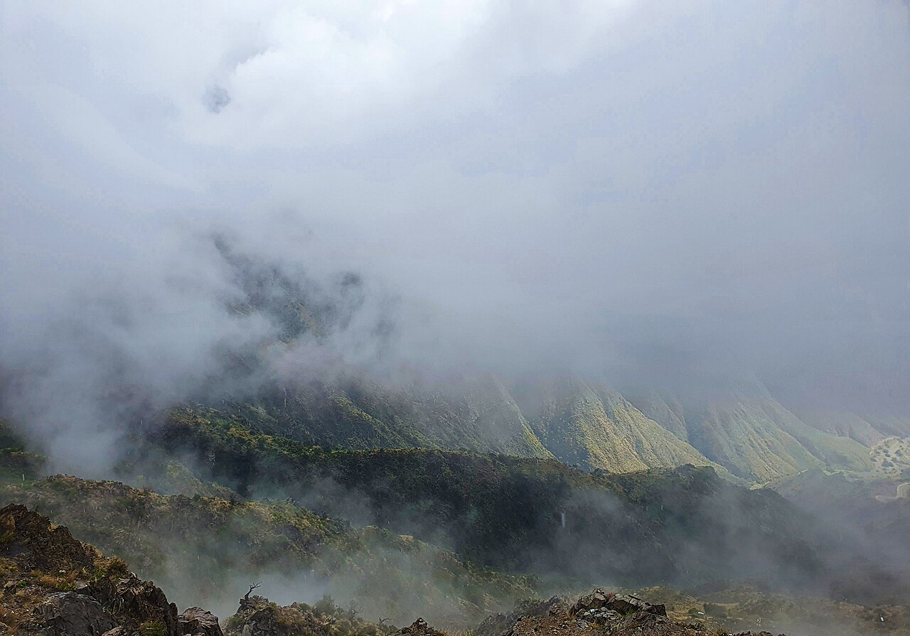
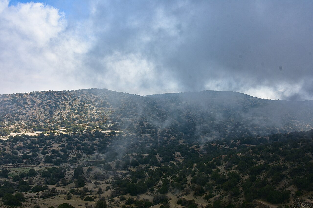
The Asir region is the undisputed heartland of hiking in Saudi Arabia. The Sarawat Mountains here reach their greatest elevation, and the combination of altitude, monsoon-influenced rainfall, and complex topography produces trail landscapes that bear no resemblance to the standard mental image of a desert kingdom. Expect fog, juniper forest, cliffs dropping hundreds of metres into cultivated terraces, and occasional patches of snow on the highest ridges in January.
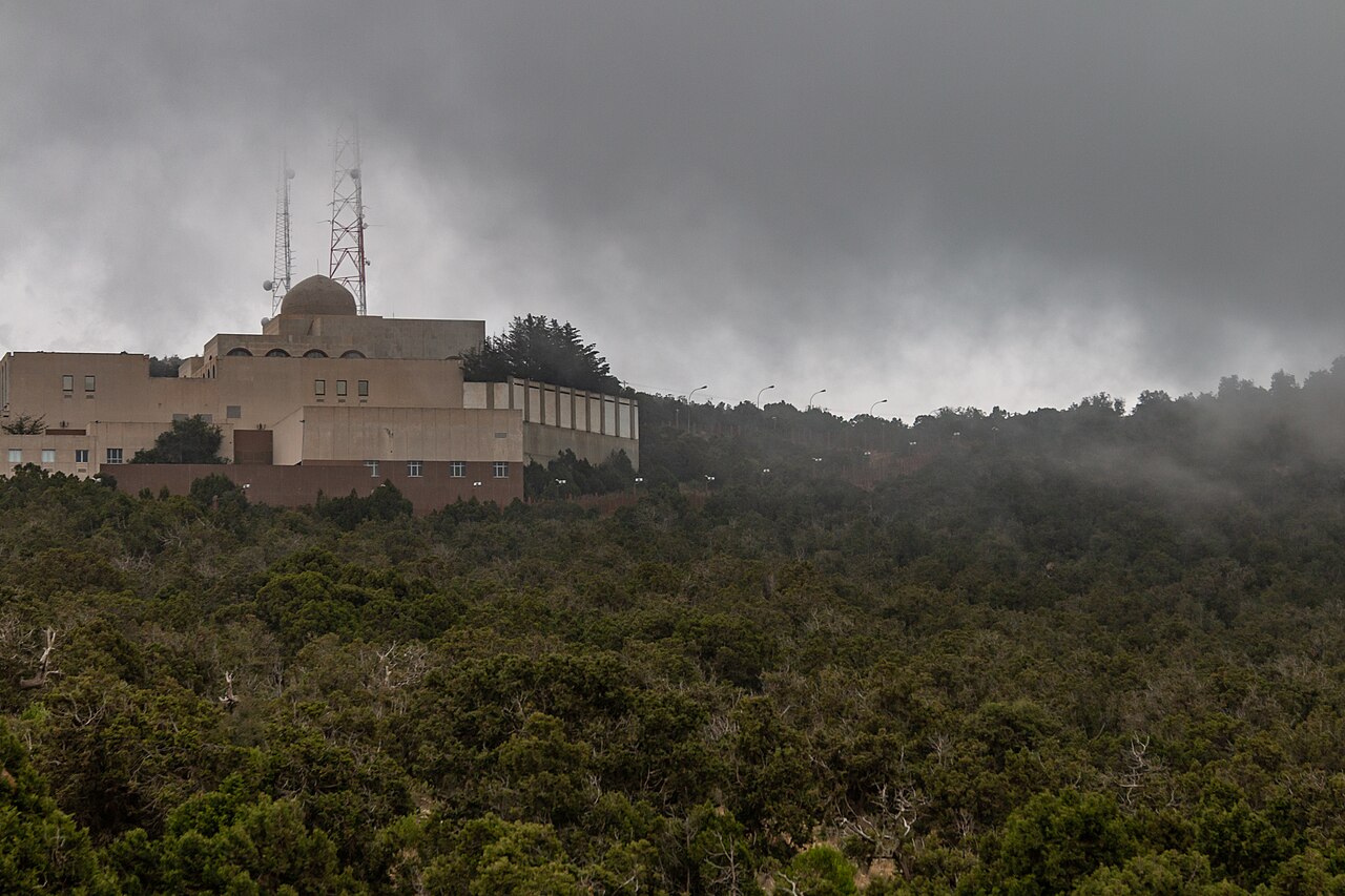
Abha (elevation ~2,200m) is the natural hub. It sits inside the park boundary of Asir National Park, one of the largest protected areas in the Middle East at 4,500 square kilometres, and is within an hour’s drive of the region’s signature peaks.
Jabal Soudah (Al Soudah) — Summit Trail
Distance: 14.5–15.4 km (loop or point-to-point depending on variant)
Elevation gain: ~1,050 m (3,450 ft)
Summit elevation: 3,015 m — the highest point in Saudi Arabia
Grade: Moderate-Hard
Duration: 6–7 hours
Permit: Not required for the main trail; Asir National Park has no entry permit system for day hikers
Best season: April–June and September–November; summers are mild (15–20°C) but foggy; January brings occasional snow above 2,800m
The Jabal Soudah trail is the benchmark hike of the kingdom. The route begins in dry, cactus-studded terrain typical of the mid-escarpment zone, passes through a mossy transition forest of Juniperus procera (African juniper) and wild olive, and emerges onto a rocky ridgeline with views that span the Sarawat Range to the west and the highland plateau to the east. The final push to the summit ridge crosses exposed granite slabs and requires careful foot placement in wet conditions.
The trail surface is well-worn — it follows a pre-modern trade route linking the Tihama coastal plain with the Abha plateau — and navigation is generally straightforward, though trail markers are sparse. Carry water; the high-altitude sections have no reliable springs. GPS tracks are available on Wikiloc and AllTrails. The Al Soudah cable car station nearby provides an emergency descent option and is a useful orientation landmark at the trailhead.
Aqabat Al Quroon — Heritage Ridge Walk
Distance: Approximately 12 km point-to-point (Al Soudah to Rijal Almaa)
Elevation change: Predominantly descending (~800 m net loss)
Grade: Moderate
Duration: 5–6 hours
Permit: Not required
Best season: October–April
This ancient caravan route drops from the Al Soudah highlands down through terraced juniper forest to the UNESCO-candidacy heritage village of Rijal Almaa — a cluster of multi-storey mudbrick towers painted in geometric patterns that have defined Asiri architecture for centuries. The path runs through natural and historic landmarks: stone cisterns, fossilised coral in exposed limestone, and stands of wild pomegranate. It is one of the most historically rich trail corridors in the kingdom and pairs well with a night in Rijal Almaa to avoid rushing the descent.
Tanomah Canyon Trails
Distance: Multiple routes, 4–10 km
Elevation: Base ~2,200 m
Grade: Easy to Moderate
Duration: 2–5 hours depending on route
Permit: Not required
Best season: Year-round (this is Saudi Arabia’s premier sport-climbing destination; its mild altitude keeps temperatures manageable even in summer)
Tanomah, positioned at roughly 2,200 metres on the escarpment above Abha, is the country’s leading sport-climbing area with more than 40 established routes from beginner-grade 4 to advanced 8b. But even non-climbers have reason to come: the canyon system offers short hiking loops through slot-canyon terrain, with sandstone walls and acacia-dotted wadi floors providing a very different character from the forested peaks of Al Soudah. See the full breakdown at Saudi Arabia Rock Climbing Guide.
Al Baha: Terraced Highlands Between Asir and Makkah
Al Baha sits at around 2,500 metres elevation on the Sarawat ridge between Asir to the south and the Hejaz lowlands to the north. It is less visited than Asir but offers landscape hiking that is arguably more intimate: narrower valleys, older stone villages, and a biodiversity that includes 40 high-altitude nature reserves within a short drive of Al Baha city. The region offers a quieter, less-developed alternative for hikers who want authentic highland Saudi Arabia without the seasonal crowds of Al Soudah. For context on the broader region, see our Abha and Asir Region guide.
Raghadan Forest Park Trails
Distance: Multiple loops, 3–8 km
Elevation: Base ~2,500 m
Grade: Easy
Duration: 1–4 hours
Permit: Not required (park entry fee applies)
Best season: March–November
Raghadan Forest Park is Al Baha’s most accessible hiking area, with trails winding through misty stands of ancient juniper and wild olive above the Tihama plain. The upper viewpoints offer dramatic drops toward the coast, and the forest is sufficiently dense that cloud cover routinely rolls in by midday, creating an atmosphere more reminiscent of the Scottish Highlands than the Arabian Peninsula. Short nature walks suit families and casual visitors; the longer loops through the forest margin involve more elevation change and require sturdy footwear.
Jabal Shada Al Aala
Distance: 6–9 km (various approaches)
Elevation: Summit ~2,910 m
Grade: Moderate-Hard
Duration: 4–6 hours
Permit: Not required
Best season: October–April
Jabal Shada is the dominant peak of the Al Baha highlands and one of the highest points in the province. The trail routes to the summit cross rugged granite terrain and require good navigation; the mountain is less well-maintained than Jabal Soudah but rewards with near-total solitude and views across the Sarawat to the Red Sea. The base area around Shada Heritage Village adds historical interest to the approach walk, with ancient stone watchtowers visible on the ridge above.
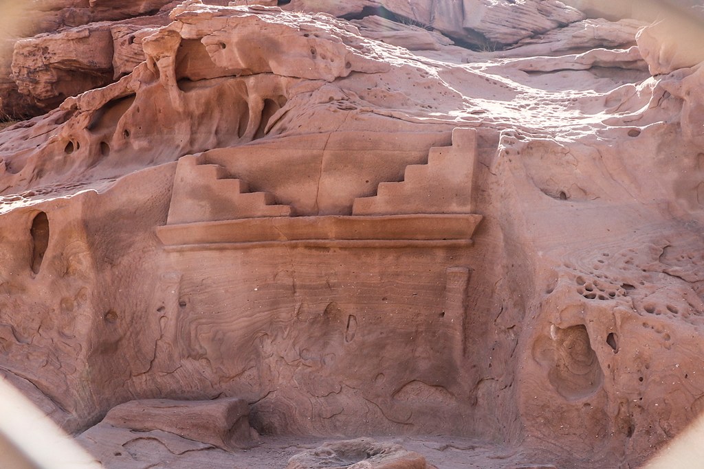
AlUla: Sandstone Canyons and Ancient Landscapes
AlUla represents something genuinely new in the world of hiking tourism: a government-funded outdoor experience built on one of the most extraordinary archaeological landscapes on Earth. The ancient Nabataean city of Hegra (Mada’in Saleh), a UNESCO World Heritage Site, sits within the same basin as the hiking trails of Sharaan Nature Reserve. The AlUla and Hegra guide covers the cultural dimension; this section focuses on the trails themselves.
Experience AlUla — the Royal Commission for AlUla’s tourism arm — manages and grades all official trails. Booking is done through the experiencealula.com platform, and guided hikes are mandatory for several routes in Sharaan Nature Reserve. The hiking season runs November to March, when daytime temperatures sit in the 18–25°C range. Summer hiking is not recommended (desert highs exceed 40°C).
The Ridge Walk — AlUla Oasis
Distance: 6 km
Elevation gain: Moderate (the initial incline is the primary challenge)
Grade: Easy-Moderate
Duration: 3 hours
Minimum age: 8 years
Booking: Through experiencealula.com
Best season: November–March
The Ridge Walk is the most popular hike in AlUla and the best introduction to the oasis landscape. The trail climbs to a ridgeline above the old town, offering panoramic views across the AlUla valley: a long green ribbon of date palm groves, ancient mudbrick architecture, and sandstone escarpments that glow amber at golden hour. The route is manageable for most fitness levels, though the opening incline requires some effort. Sunrise starts are strongly recommended — by 10 am the valley is in full glare.
Hidden Valley — Sharaan Nature Reserve
Distance: 4 km
Grade: Easy-Moderate
Duration: 3 hours
Minimum age: 7 years
Guided: Yes (mandatory within Sharaan)
Best season: November–March
Hidden Valley threads through soft sand and exposed rock within the Sharaan Nature Reserve, a 1,500-square-kilometre protected area established in 2020 under AMAALA’s conservation framework. The trail passes through a lush valley microhabitat sheltering hundreds of plant and animal species, including the Arabian sand gazelle. The sandstone walls overhead show ancient Lihyanite and Dadanitic inscriptions — some dating back 2,500 years — that require a guide to properly interpret. This is not a high-exertion route; the payoff is ecological and historical immersion.
Acacia Trail — Sharaan Nature Reserve
Distance: 6 km
Grade: Moderate
Duration: 4 hours
Minimum age: 12 years
Guided: Yes (mandatory)
Best season: November–March (night version available)
The Acacia Trail covers more varied terrain than Hidden Valley: desert dunes, sandstone mountain sections, and ancient inscription sites, with the dominant vegetation — old-growth Acacia tortilis — giving the trail its name. The route includes some steep sections and loose sand, making the minimum age restriction meaningful. An evening version of this trail is offered during peak season, with guides using red-light torches to preserve night-vision while walking through complete desert darkness — an experience rare in organised trail tourism anywhere in the world.
Journey Through Time Trail
Distance: 8 km
Grade: Moderate
Duration: 5–6 hours
Minimum age: 8 years
Guided: Yes
Best season: November–March
AlUla’s most ambitious day hike links five distinct terrain types — sand, volcanic rock, acacia woodland, inscribed cliff sections, and ancient wadi channels — in an 8-kilometre arc that functions as a geological and historical cross-section of the valley. The 2,000-year-old Lihyanite and Nabataean pictographs visible en route are the highlight, turning what would elsewhere be a straightforward moderate walk into a genuinely scholarly experience. The trail is not technically difficult, but the duration and midday heat mean preparation matters: minimum 2 litres of water, sun protection, and sturdy footwear are non-negotiable.
Tabuk: Canyons and Snowcapped Peaks of the Northwest
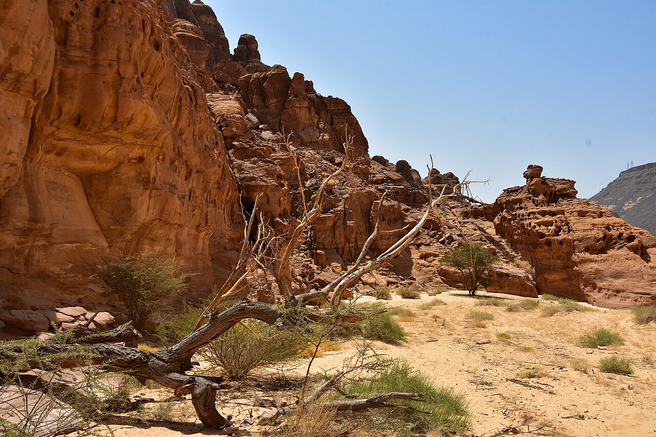
The Tabuk region in northwestern Saudi Arabia offers two sharply contrasting hiking environments: the deep sandstone canyon of Wadi Disah, one of the most spectacular gorge walks in the Middle East, and the granite mass of Jabal al-Lawz, the kingdom’s second highest range and — uniquely in Saudi Arabia — a winter snowscape. More canyon options are detailed in our Tabuk and Wadi Disah guide.
Wadi al-Disah — Canyon Walk
Distance: 8–15 km (full canyon is 15 km; most hikers do a 4–8 km return section)
Canyon wall height: Up to 400 m
Grade: Easy-Moderate (flat terrain, some scrambling and shallow wading)
Duration: 3–7 hours depending on distance covered
Permit: Not required
Access: 250 km southwest of Tabuk city (approximately 2.5 hours by road)
Best season: November–March; avoid in summer (extreme heat) and immediately after heavy rain (flash flood risk)
Wadi al-Disah is the defining hiking destination of northwestern Saudi Arabia. The canyon cuts through Tabuk’s sandstone plateau over 15 kilometres, its walls rising to 400 metres and squeezing at certain points to gaps of barely 10 metres. The canyon floor is unexpectedly fertile: natural freshwater springs feed groves of date palms, Nabataean rock-cut tombs face each other across the wadi like forgotten sentinels, and seasonal pools appear after winter rains. It is a place with serious physical drama and an ancient human presence that neither category adequately captures.
The hiking itself is not technically demanding. The terrain is predominantly flat wadi rock with occasional ankle-deep stream crossings and sections where you scramble over boulders. Navigation is straightforward — you follow the canyon. The challenge is preparation: carry substantial water (springs are drinkable but unreliable), inform someone of your plans, and treat any weather forecast involving upstream rain with immediate respect. Flash floods in Wadi Disah arrive without warning and are life-threatening.
More wadi terrain is detailed in our Saudi Arabia Wadi Walks guide.
Jabal al-Lawz — Mountain Approach
Summit elevation: 2,549 m (some sources cite 2,580 m)
Road-access elevation: ~2,100 m (public access ends at a military installation below the summit)
Grade: Moderate (road section), Hard (off-trail approach)
Distance: Varies by approach; the mountain road ascent covers significant horizontal distance
Permit: Not required for lower slopes; summit zone has restricted military access
Best season: November–March (snow possible December–February above 2,000 m)
Access: ~130 km east of Haql, 2.5 hours from Tabuk city
Jabal al-Lawz is the highest range in the Hejaz Mountains and the most reliable location in Saudi Arabia for snow. The approach road reaches 2,100 metres before a military installation prevents public access to the true summit. Below this restricted zone, the mountain offers legitimate hiking through granite terrain with dramatic views across the Hejaz escarpment toward the Gulf of Aqaba. Winter hiking here requires cold-weather layering — the combination of altitude and latitude produces genuinely cold conditions by Gulf standards, with temperatures regularly dipping below 5°C at night above 2,000 metres.
Hail: Granite Boulders and Wadi Hiking
The Hail region in north-central Saudi Arabia receives less attention than the southwest highlands or the northwest canyons, but the Jabal Aja Protected Area — a granite mountain range running roughly 100 kilometres and covering 200,000 hectares — offers accessible, family-friendly wadi hiking within 10–25 kilometres of Hail city. The landscape is pinkish granite rather than sandstone, the wadis are wider and more open than Wadi Disah, and the complete absence of tourist infrastructure means you are almost always alone.
Jabal Aja Wadi Trails
Elevation range: 900–1,550 m
Distance: Multiple routes, 4–12 km
Grade: Easy to Moderate
Duration: 2–6 hours
Permit: Not required
Access: 10–25 km from Hail city
Best season: November–March
The wadi floors of Jabal Aja are wide, sandy, and flanked by pink granite boulders that turn gold in the late afternoon sun. There are no formal trail markers, but the major wadis are navigable on obvious sandy paths, and the open terrain makes it easy to see where you’re going. The range’s status as an Important Bird Area means that winter visits (the bird migration season) add ornithological interest to the landscape appeal — over 200 bird species have been recorded in the Jabal Aja Protected Area.
Several viewpoints accessible by 4WD from Hail provide elevated starting points, reducing ascent time and opening up ridge walks with views across the Nefud Desert to the north. The absence of any organised trail system is both the challenge and the attraction — Jabal Aja rewards hikers who are self-sufficient and comfortable with navigation by landmark and GPS rather than waymarked paths.
Practical Hiking Information for Saudi Arabia
Permits and Access
The vast majority of hiking in Saudi Arabia requires no permit. Open desert, mountain terrain, and most wadis are accessible without registration. Three categories of area require advance consideration:
- National parks and nature reserves: Asir National Park and Sharaan Nature Reserve require trail bookings through their respective management platforms (experiencealula.com for AlUla trails; no pre-booking system for Asir day hikes as of 2026). The National Center for Vegetation Cover (NCVC) issues digital camping permits for protected areas via its Nabati platform.
- Royal reserves: Several areas adjacent to popular hiking terrain are designated royal hunting reserves with restricted access. These are signposted but not always mapped on consumer apps — when in doubt, ask locally.
- Military zones: The summit area of Jabal al-Lawz and certain sections of the Tabuk highlands are restricted due to military presence. These restrictions are clearly marked and non-negotiable.
- Water: Carry a minimum of 2 litres per person for any trail under 10 km; 3–4 litres for longer routes. Reliable natural water sources are rare on most Saudi trails.
- Sun protection: SPF 50+ sunscreen, a wide-brimmed hat, and UV-protective clothing. The reflected glare from light sandstone amplifies UV exposure significantly.
- Navigation: Download the relevant GPS track before leaving mobile signal. Saudi trails are largely unmarked; AllTrails and Wikiloc both have user-contributed routes for the major trails covered in this guide.
- Footwear: Ankle-supporting trail shoes or boots are appropriate for all routes in this guide. Running shoes are adequate for the flat canyon walks of Wadi Disah; the summit trails of Jabal Soudah and Jabal Shada warrant stiff-soled boots with grip.
- Emergency contact: Inform someone at your accommodation of your planned route and expected return time. Saudi rescue services exist but response times in remote areas are long.
Best Seasons by Region
| Region | Optimal Season | Notes |
|---|---|---|
| Asir / Al Baha | October–June | Summers mild at altitude (15–22°C); snow possible Jan–Feb above 2,800m; fog common year-round |
| AlUla | November–March | Desert climate; summer highs exceed 40°C; all official trails close in summer |
| Tabuk (Wadi Disah) | November–March | Flash flood risk after rain regardless of season; avoid in summer |
| Tabuk (Jabal al-Lawz) | November–February | Snow possible December–February; best for winter hikers |
| Hail (Jabal Aja) | October–March | Summer temperatures in Hail basin exceed 40°C; mountain trails remain cooler but not recommended |
Visa and Entry
All foreign nationals require a visa to enter Saudi Arabia. The tourist e-visa is available to citizens of 49 countries and can be obtained online at visitsaudi.com within minutes. It costs approximately $80 USD, allows stays of up to 90 days, and covers both leisure and hiking activities. The Saudi Arabia Visa Guide 2026 covers the full application process, eligible nationalities, and entry requirements in detail.
What to Carry
Saudi Arabia’s climate variability across regions and altitudes means gear lists vary considerably. The non-negotiables apply everywhere:
Guides and Tour Operators
Guided hiking is mandatory within Sharaan Nature Reserve (AlUla) and is strongly recommended for technical routes in Asir, multi-day routes anywhere, and all Wadi Disah excursions. Husaak Adventures (husaak.com) operates guided hiking and wadi experiences in both Asir and AlUla with English-speaking guides. Arabia Trail (arabiatrail.net) covers the Tabuk region including Wadi Disah.
Planning Your Hiking Route
The most efficient hiking itinerary in Saudi Arabia combines two regions. The classic combination is Asir and AlUla: fly into Abha (Asir’s regional airport has direct connections from Riyadh and Jeddah), hike Jabal Soudah and the Aqabat Al Quroon heritage trail over three days, then take an internal flight to AlUla for the Sharaan Reserve trails. Both legs work perfectly in the November–March window.
For the northwest, Wadi Disah and Jabal al-Lawz combine naturally from a Tabuk base — 2.5 hours drive to each, and the contrast between canyon floor hiking and high-altitude granite terrain covers the full range of what the region offers. Tabuk also connects to AlUla (approximately 4 hours’ drive via Highway 375), making a Tabuk–AlUla circuit viable for independent travellers with their own vehicle.
Hail fits naturally into a Riyadh-based itinerary as a weekend destination (approximately 6 hours’ drive north) or as a stopover on the overland route between Riyadh and Tabuk. The Jabal Aja wadi trails are at their best in December and January, when the Nefud Desert air is crisp and the low winter sun makes the granite boulders glow.
For a full breakdown of travel logistics — transport, accommodation, and regional connections — the Saudi Arabia Travel Guide 2026 covers each of these regions in depth. And if you want to extend your mountain experience with technical climbing, the Saudi Arabia Rock Climbing Guide covers Tanomah and the country’s emerging sport-climbing scene in detail.