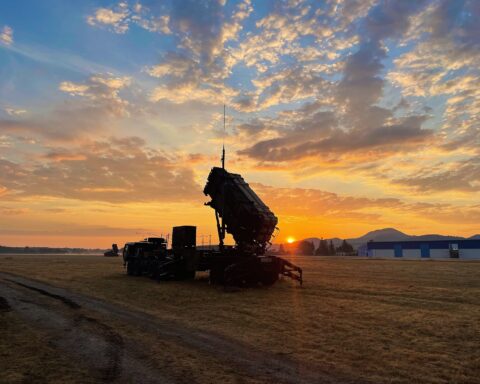

RIYADH — On March 27, seventeen Iranian drones crossed into Saudi airspace over the Eastern Province and every one of them was destroyed before reaching its target. The interceptors that brought them down — Patriot PAC-3 missiles, short-range air defense guns, and electronic warfare systems — received their instructions from a chain of sensors, satellites, and human analysts stretching from geosynchronous orbit to a hardened bunker beneath the Saudi desert. The hardware gets the headlines. The intelligence architecture that tells the hardware where to aim is the reason Saudi Arabia is still standing.
Four weeks into the Iran war, the Kingdom’s interception rate against drones and ballistic missiles exceeds 90 percent, according to Saudi Ministry of Defense statements. That number is not the product of superior firepower alone. It reflects a surveillance and intelligence ecosystem — part American, part Saudi, part coalition — that has been assembled over four decades and stress-tested in real time since February 28. Understanding how that ecosystem functions, where it excels, and where it could catastrophically fail is essential to understanding the war itself.
Table of Contents
- What Does Saudi Arabia’s Air Defense Intelligence Network Look Like?
- How Do Satellites Detect Iranian Missile Launches in Seconds?
- The Peace Shield Architecture That Links Every Sensor in the Kingdom
- Why Are Iranian Drones So Much Harder to Detect Than Missiles?
- Inside the Combined Air Operations Center at Al Udeid
- The Detection Hierarchy — A Layered Framework for Gulf Air Defense
- How Does Intelligence Flow From Colorado to Riyadh in Twelve Seconds?
- What Role Does Human Intelligence Play in the Drone War?
- The Ukrainian Counter-Drone Experts Rewriting Gulf Defense Doctrine
- The Fatal Flaw in Saudi Arabia’s Intelligence Shield
- What Happens When Iran Learns to Blind the Sensors?
- Frequently Asked Questions
What Does Saudi Arabia’s Air Defense Intelligence Network Look Like?
Saudi Arabia’s air defense intelligence network is a layered system of space-based infrared satellites, ground-based radars, airborne early warning aircraft, naval sensors, signals intelligence platforms, and human intelligence operatives that together provide the early warning and targeting data required to intercept Iranian missiles and drones. No single component can function independently. The system’s effectiveness depends on the speed and reliability of data fusion across all layers.
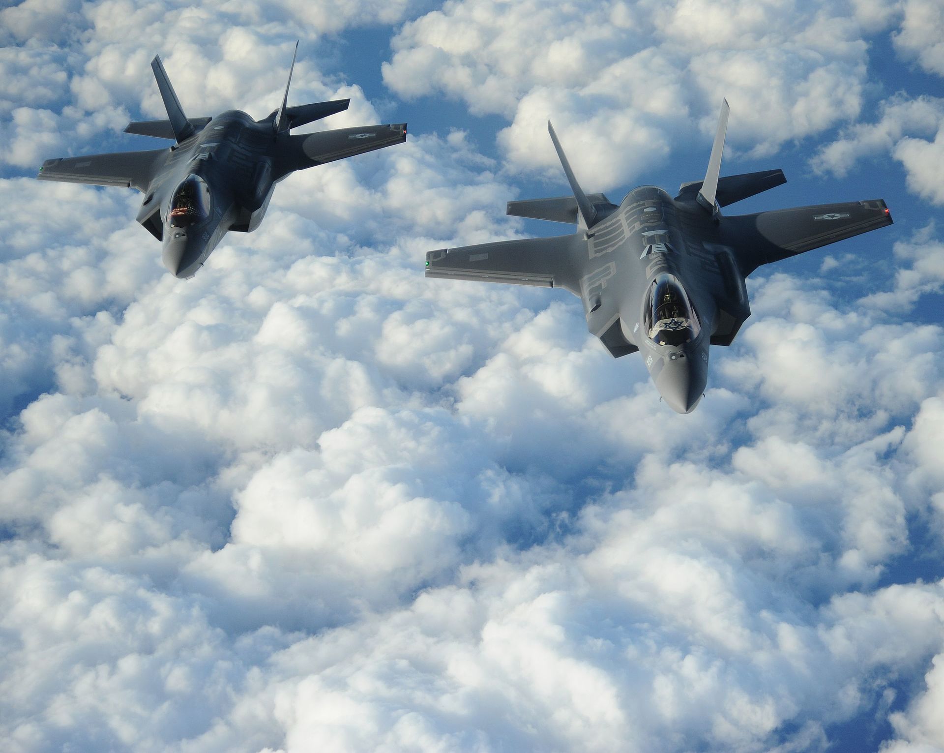
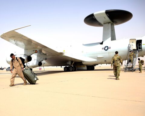
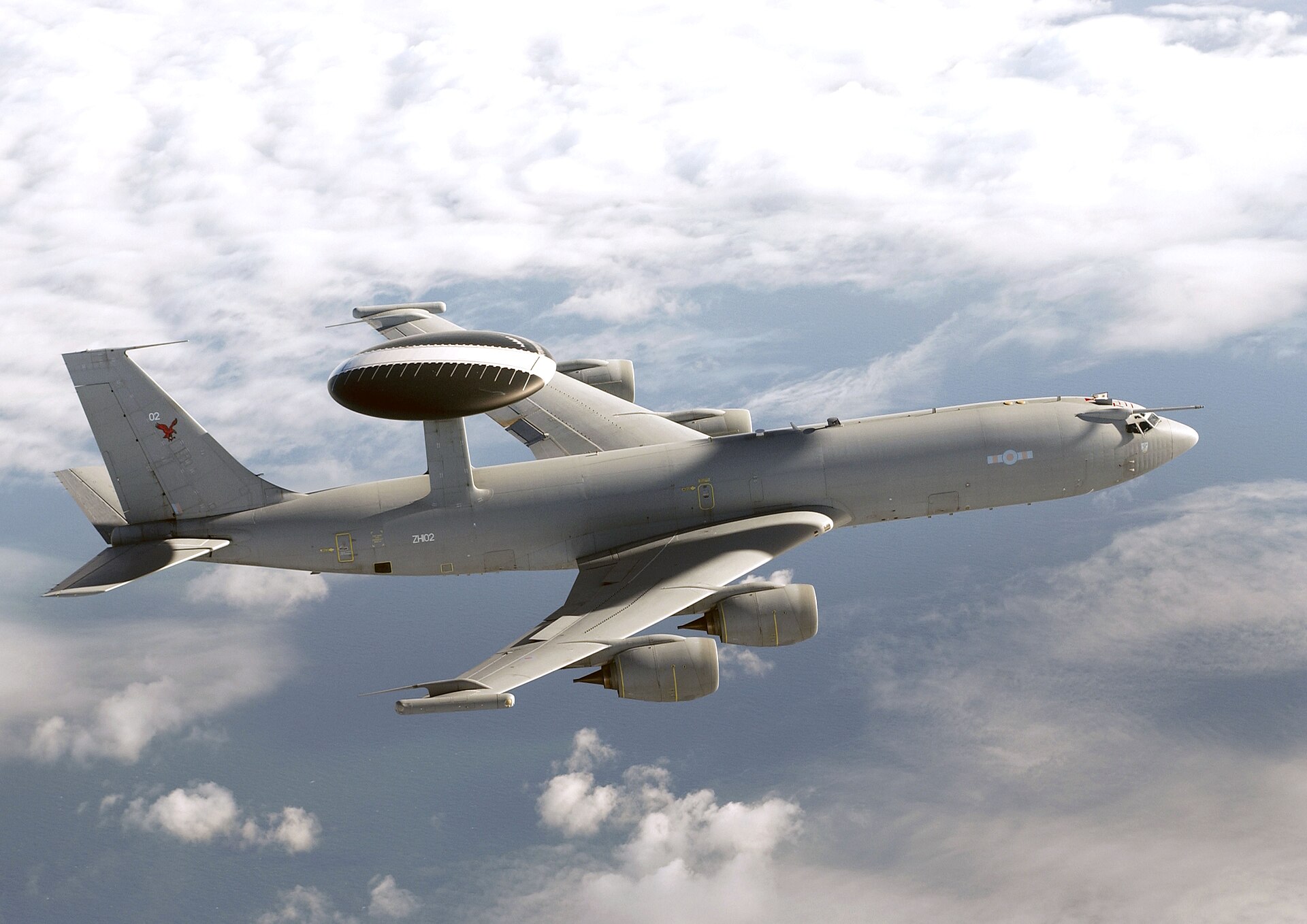
At the apex sits the Space-Based Infrared System, a constellation of six American satellites in geosynchronous orbit that detect the thermal signature of missile launches within seconds. Below that, seventeen AN/FPS-117 long-range three-dimensional radars and six AN/TPS-43 tactical radars blanket the Kingdom’s airspace under the Peace Shield command-and-control architecture. Five Royal Saudi Air Force E-3A AWACS aircraft — making Saudi Arabia one of only four nations to operate the type — provide airborne surveillance capable of tracking more than 600 targets simultaneously at ranges exceeding 375 kilometres.
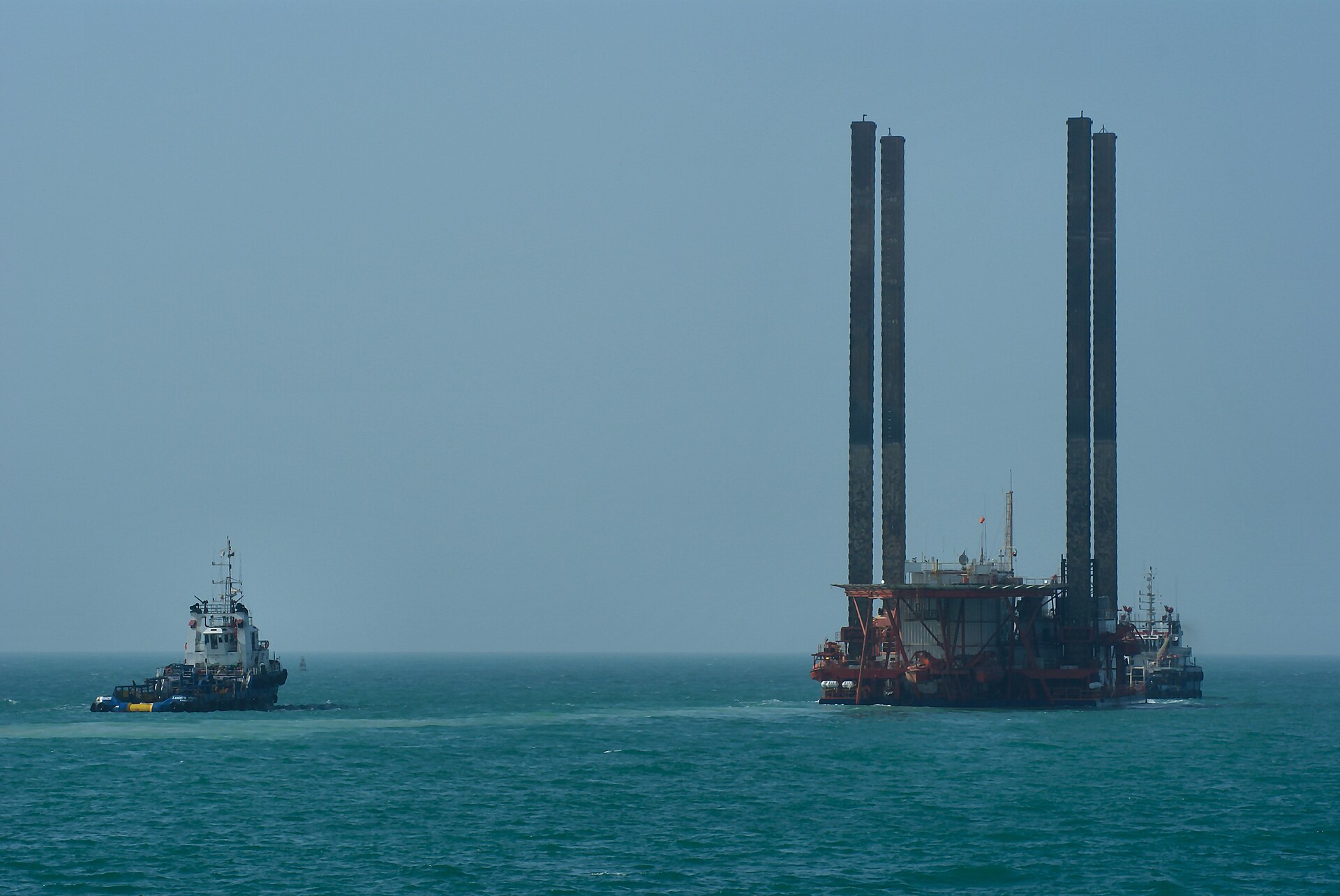
The US military adds its own dense layer. AN/TPY-2 transportable radars, each with a range approaching 2,000 miles, have been deployed to Saudi Arabia, the UAE, and Qatar. US Navy Aegis destroyers patrol the Persian Gulf with AN/SPY-1 radars providing up to 200 miles of coverage. MQ-9 Reaper drones maintain persistent surveillance over suspected drone launch sites in western Iran and southern Iraq. And at the centre of the web sits the Combined Air Operations Center at Al Udeid Air Base in Qatar, where American, Saudi, British, and coalition officers fuse this data into a single operational picture that drives every engagement decision.
The result is what military planners call a “sensor-to-shooter” chain — a continuous link from detection to destruction. When it works, it produces the results the world has seen over Riyadh, Dhahran, and the Eastern Province. When any link degrades, the consequences are measured in civilian casualties and burning oil infrastructure.
The Middle East briefing 3,000+ readers start their day with.
One email. Every weekday morning. Free.

How Do Satellites Detect Iranian Missile Launches in Seconds?
The first warning of an Iranian ballistic missile launch comes not from radar but from space. The US Space Force’s Space-Based Infrared System detects the intense thermal radiation produced by a missile’s rocket motor within seconds of ignition, transmitting an alert to ground stations before the missile has cleared its launch pad. SBIRS comprises six bus-sized satellites positioned 36,000 kilometres above the Earth in geosynchronous orbit, according to Lockheed Martin, the system’s prime contractor.
The physics are straightforward. A ballistic missile’s exhaust plume burns at temperatures exceeding 2,000 degrees Celsius, creating an infrared signature visible from orbit against the cooler background of the Earth’s surface. SBIRS sensors, cooled to near absolute zero to maximise sensitivity, identify this thermal anomaly, classify it as a launch event, and relay the data to the Buckley Space Force Base in Colorado. Operators at Buckley’s missile warning centre process the alert and disseminate it to US Central Command, which shares it with allied forces in the Gulf within a cycle measured in seconds, not minutes.
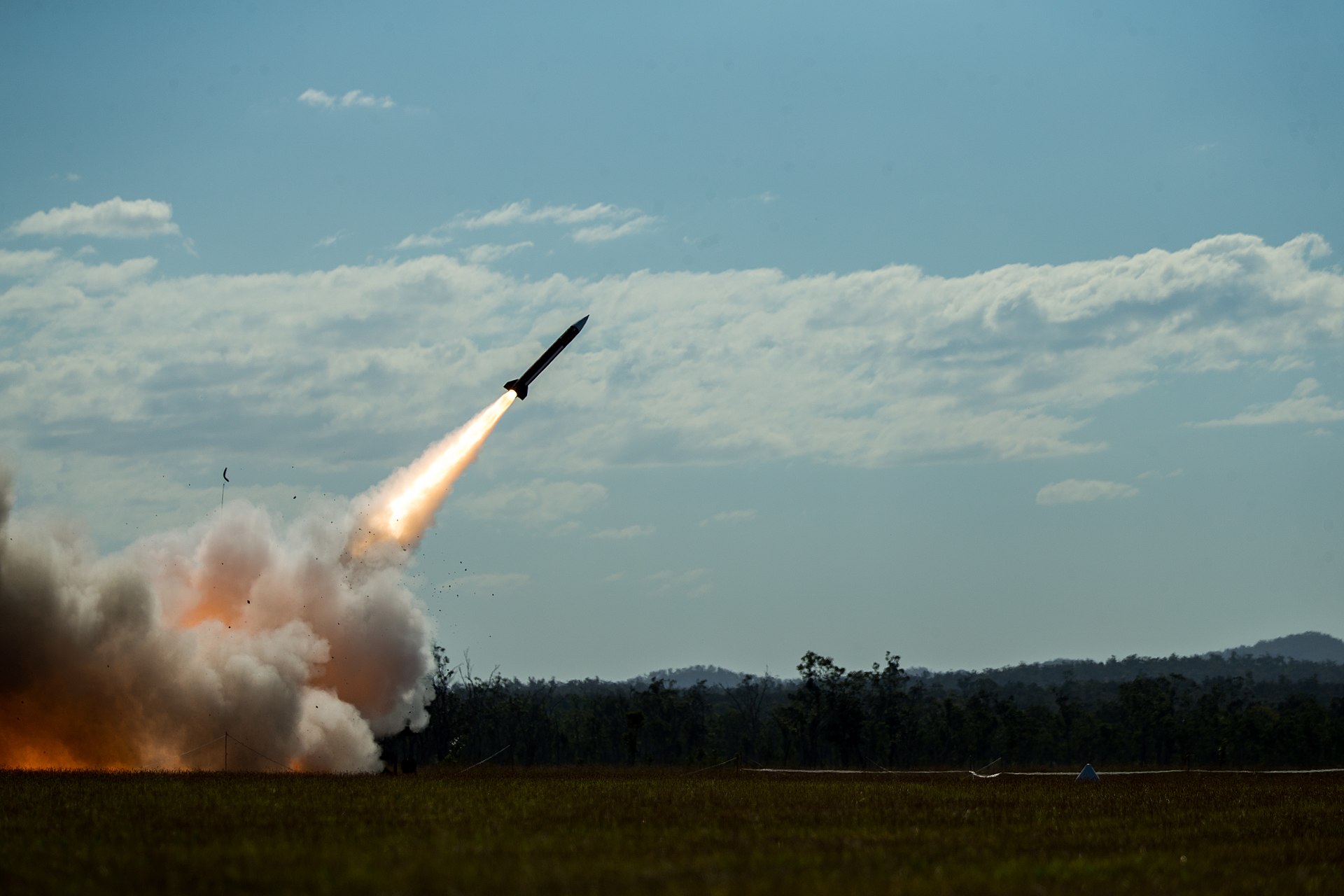
The system proved its operational value during Iran’s January 2020 ballistic missile strike on Al Asad Air Base in Iraq, when SBIRS detected the launch of at least twelve missiles and provided sufficient warning for US personnel to reach concrete shelters before impact. The US Space Force later confirmed that the early warning came with enough time — the missiles were airborne for approximately seven minutes — to avert casualties, according to a 2021 report by C4ISRNet. In March 2026, with Iran firing multiple ballistic missiles at Saudi territory, the same satellite constellation has provided the opening seconds of the kill chain that allows Patriot and THAAD batteries to engage incoming threats.
The satellites, however, have a critical limitation: they are optimised for detecting the large thermal signatures of ballistic missiles and cruise missiles, not the small gasoline-powered engines of Iranian Shahed drones. Drones produce minimal heat — insufficient to register against background radiation from space. This gap in the satellite layer is the reason Saudi Arabia’s air defense architecture requires multiple additional detection layers operating simultaneously.
The Peace Shield Architecture That Links Every Sensor in the Kingdom
Peace Shield is the name given to Saudi Arabia’s national air defense command-and-control system, a hardened, networked architecture that integrates every radar, interceptor battery, and communications link in the Kingdom into a single fused operational picture. Originally contracted to Boeing in 1985 and progressively upgraded through 2022, Peace Shield represents one of the most expensive and comprehensive air defense integration programmes ever built outside of the United States and NATO.
The system’s ground-based detection backbone comprises seventeen General Electric AN/FPS-117 long-range three-dimensional radars distributed across the Kingdom, each capable of detecting aircraft and missiles at ranges exceeding 450 kilometres, according to GlobalSecurity.org. Six Northrop Grumman AN/TPS-43 tactical radars supplement the fixed network with deployable capability. Every radar feeds into a central command operations centre and five sector command-and-operations centres, connected by redundant nationwide communications links.
The critical upgrade completed between 2018 and 2022 added Link 16 tactical data link capability, the NATO-standard protocol that allows Saudi air defense units to share targeting data in real time with American, British, and coalition aircraft and warships. Before Link 16, Saudi radars and coalition assets operated on separate data networks, creating latency and requiring voice communication to coordinate engagements. After the upgrade, a Patriot battery in Dhahran can receive targeting data directly from a US Navy Aegis destroyer in the Persian Gulf or an RAF Typhoon operating over Iraqi airspace — all within the same digital picture.
The command centre itself is designed to survive. According to defense analysts at the International Institute for Strategic Studies, the primary facility is hardened to withstand a direct conventional strike, with independent power generation, redundant communications, and the ability to transfer command authority to alternate sites if compromised. Iran’s March 2026 strikes have tested this resilience. When Iranian ballistic missiles targeted radar installations linked to US THAAD systems in Saudi Arabia, Jordan, and the UAE, according to Politics Today, the Peace Shield architecture’s redundancy allowed gap coverage from adjacent radar sites and airborne platforms within minutes.
The system is not infallible. Peace Shield was designed in the 1980s to track conventional aircraft and ballistic missiles — threats with large radar cross-sections moving at predictable speeds and altitudes. The low, slow, small signature of Iranian drones was not part of the original threat calculus. Adapting a Cold War-era architecture to a swarming drone threat has required improvisation that the Kingdom’s $80 billion annual military budget is still racing to fund. The consequences of those gaps became starkly apparent on 27 March when an Iranian missile and drone attack struck Prince Sultan Air Base, wounding ten Americans and damaging an E-3 Sentry AWACS — one of the very surveillance platforms on which the detection chain depends.
Why Are Iranian Drones So Much Harder to Detect Than Missiles?
Iranian Shahed-series drones are harder to detect than ballistic missiles because they produce almost no thermal signature visible to space-based sensors, have a radar cross-section roughly the size of a large bird, and fly at altitudes deliberately chosen to exploit the physical limitations of ground-based radar. These three characteristics make the Shahed the most cost-effective offensive weapon in Iran’s arsenal and the most difficult to counter with conventional air defense intelligence.
The Shahed-136 has a radar cross-section of approximately 0.01 square metres, according to defense analysts at The National. By comparison, a ballistic missile in flight presents a cross-section hundreds of times larger. At 0.01 square metres, the drone reflects so little radar energy that ground-based systems struggle to distinguish it from birds, weather clutter, or terrain returns. The problem worsens at low altitudes, where ground clutter energy dominates radar returns as the beam’s footprint encompasses vast areas of vegetation, terrain, and man-made structures.
Shahed drones cruise at speeds between 140 and 190 kilometres per hour — slower than most civilian aircraft and far slower than the supersonic threats that air defense radars are optimised to track. They operate at altitudes between 20 and 2,000 metres, with terminal attack phases often dropping below 200 metres to exploit radar blind spots near the ground. This combination of low speed, low altitude, and tiny cross-section means that a Shahed approaching a Saudi oil facility may not be detected until it is within 20 to 40 kilometres of its target, leaving less than 10 minutes for engagement.
Trump administration officials told lawmakers during a closed-door briefing that Iran’s Shahed attack drones represent a major challenge and that US air defenses will not be able to intercept them all, according to CNN reporting from March 4, 2026. The Pentagon subsequently deployed the Merops drone interceptor system to the region — a specialized counter-UAS platform designed specifically for the low-altitude, low-signature threat that conventional systems struggle against.
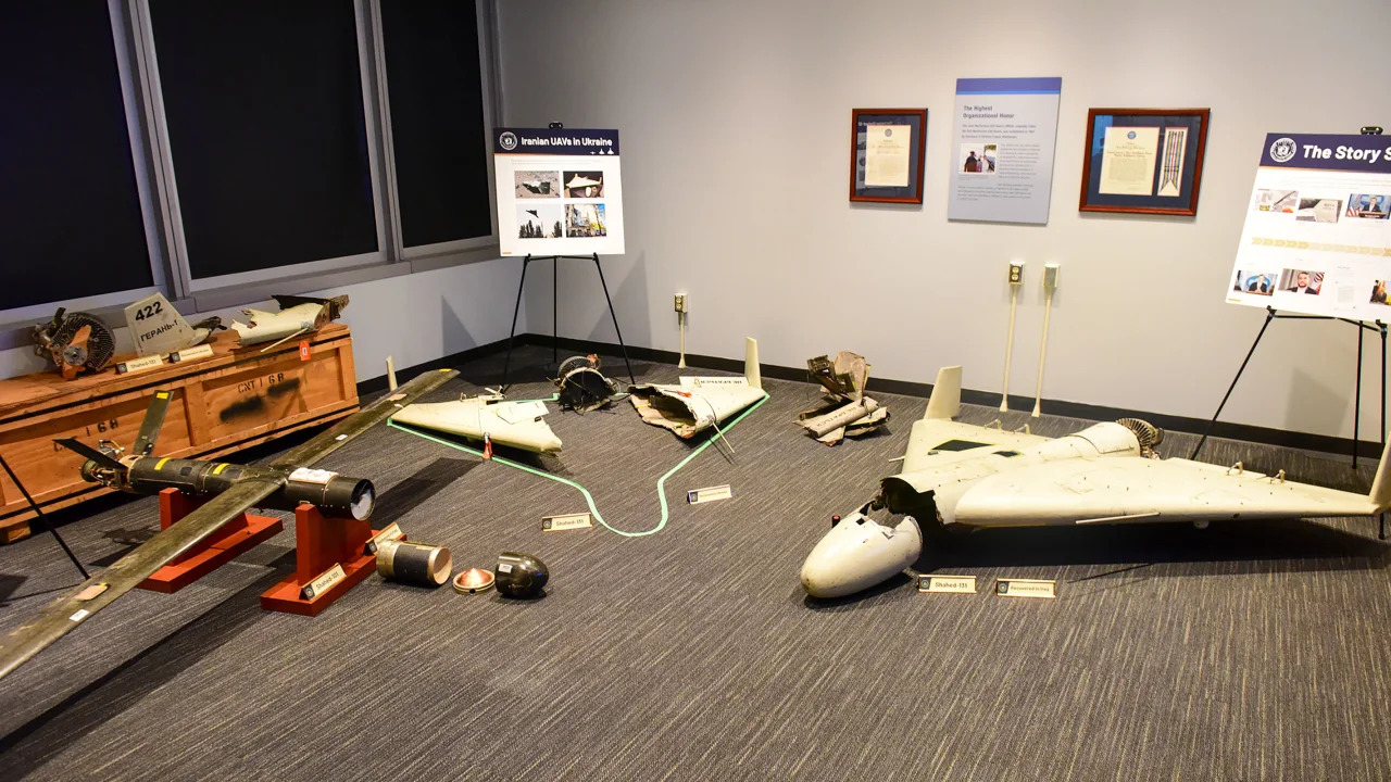
The detection gap has driven a search for alternative sensor technologies. Acoustic sensors that listen for the distinctive sound of Shahed engines, radio-frequency scanners that detect drone control signals, and electro-optical cameras with AI-driven target recognition have all been deployed to supplement radar. Ukraine’s experience defending against more than 54,000 Russian-launched Shahed drones has proven that layered detection using these non-radar sensors can compensate for the physics limitations, but the Gulf environment — vast desert expanses, extreme heat distortion, sandstorms — presents challenges that the Ukrainian steppe does not.
Inside the Combined Air Operations Center at Al Udeid
The Combined Air Operations Center at Al Udeid Air Base in Qatar is the nerve centre of coalition air operations across the Middle East, fusing intelligence from every sensor platform in the region into a single common operating picture displayed on walls of interconnected screens in a facility the size of a commercial aircraft hangar. CAOC has directed every air engagement in the Iran war since February 28.
Al Udeid, located southwest of Doha, hosts the forward headquarters of US Air Forces Central Command. The CAOC within the base operates around the clock with approximately 1,200 personnel from the United States, United Kingdom, Australia, and Gulf coalition partners, according to US Central Command. Operators work in shifts of eight to twelve hours, monitoring real-time feeds from SBIRS satellites, ground radar networks, AWACS orbits, naval Aegis radar, drone surveillance, and signals intelligence platforms.
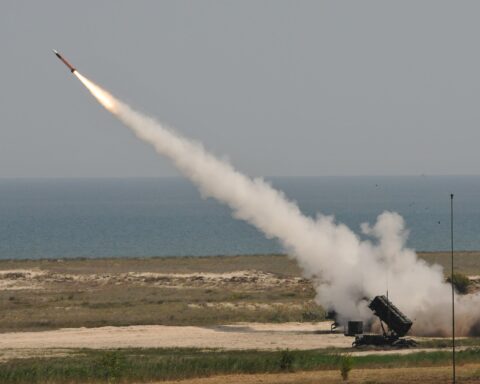
The CAOC’s function is data fusion and decision acceleration. When SBIRS detects a missile launch or when an AN/TPY-2 radar picks up a drone swarm forming over western Iran, the data arrives at CAOC within seconds. Operators classify the threat — ballistic missile, cruise missile, drone, or false alarm — and assign it to the appropriate interceptor system. THAAD engages high-altitude ballistic threats. Patriot PAC-3 handles lower-trajectory missiles and faster drones. Short-range systems and electronic warfare address the lowest and slowest threats. The goal is to match each incoming object with its optimal killer without wasting expensive interceptors on low-value targets.
This process has been dramatically compressed during the Iran war. In peacetime exercises, threat classification and weapon assignment might take minutes. Under combat conditions, with multiple simultaneous incoming threats, the cycle from detection to weapon assignment has been reduced to what Saudi military officials describe as near-automatic, with the system recommending the optimal interceptor and firing solution for human confirmation rather than requiring operators to build the engagement from scratch. The Link 16 data link added to Saudi Arabia’s Peace Shield between 2018 and 2022 is the connective tissue that makes this speed possible, allowing every friendly sensor and shooter in the theatre to operate from the same digital picture.
Al Udeid has also become the primary intelligence-sharing hub for the emerging Gulf air defense coalition that quietly includes Israeli participation. Israel’s 2021 integration into CENTCOM’s area of responsibility was described by US military officials as “a game changer” because it made it easier to share intelligence and provide early warning across countries that had no formal diplomatic relationship. Since the Iran war began, this informal intelligence-sharing framework has been activated at a tempo and depth that would have been unimaginable a decade ago.
The Detection Hierarchy — A Layered Framework for Gulf Air Defense
The intelligence architecture defending Saudi Arabia operates as a hierarchy of detection layers, each optimised for a different threat type, range, and altitude band. No single layer can cover every threat. The system’s effectiveness depends on overlapping coverage that compensates for the blind spots inherent in each technology. The following framework maps the six primary detection layers, their capabilities, and their vulnerabilities.
| Layer | Platform | Detection Range | Response Time | Primary Threat | Critical Vulnerability |
|---|---|---|---|---|---|
| Space | SBIRS (6 satellites) | Global | 5-15 seconds | Ballistic missiles | Cannot detect drones; limited cruise missile detection |
| High Altitude | AN/FPS-117 ground radar (17 sites) | 450+ km | 30-60 seconds | Aircraft, ballistic missiles | Ground clutter masks low-altitude targets |
| Airborne | E-3A AWACS (5 aircraft) | 375+ km | 30-90 seconds | All aerial threats including drones | Limited orbit hours; only 5 airframes for entire Kingdom |
| Transportable | AN/TPY-2 radar (US Army) | 3,200 km | 15-30 seconds | Ballistic missiles, large drones | Fixed site; targeted by Iranian strikes |
| Naval | Aegis AN/SPY-1 (US Navy) | 320 km | 15-45 seconds | All threats over water | Ships must be forward-deployed; repositioned for other theatres |
| Counter-UAS | Acoustic, RF, EO/IR sensors | 5-40 km | 10-60 seconds | Low/slow drones | Short range; requires dense deployment; weather-dependent |
The hierarchy reveals a structural gap between layers three and six. Threats entering at medium altitude — above the counter-UAS sensors but below optimal AWACS detection — face the weakest coverage. Iranian drone operators have exploited this gap by programming approach profiles that descend through the medium-altitude band during the final phase of flight, arriving in the counter-UAS detection envelope with minimal warning time.
The framework also exposes a concentration risk. Layers one, four, and five are entirely American-operated. Layer two is Saudi-operated but American-built and dependent on American maintenance contracts. Only layers three and six include meaningful non-American capability — and layer six, the counter-UAS sensors, represents the newest and least mature technology in the stack. If US assets were withdrawn or redirected, Saudi Arabia would lose its space-based warning entirely, lose its most capable ground radar, and lose its naval detection layer — retaining only its AWACS fleet and its recently deployed counter-drone sensors.
How Does Intelligence Flow From Colorado to Riyadh in Twelve Seconds?
Intelligence on an Iranian missile launch travels from the SBIRS satellite constellation to a Saudi Patriot battery in approximately twelve seconds through a chain of five relay points. The speed of this chain — and the consequences of any delay within it — determines whether an interceptor launches in time to meet its target.
The chain begins when a SBIRS satellite’s infrared sensor detects a thermal bloom over an Iranian launch site. The satellite downlinks the raw data to a ground processing station, which feeds into the Missile Warning Center at Buckley Space Force Base in Colorado Springs. Analysts at Buckley confirm the launch, classify the missile type based on trajectory and thermal characteristics, and transmit the warning to US Space Command’s Combined Space Operations Center. From there, the alert is relayed simultaneously to CENTCOM’s CAOC at Al Udeid and to tactical units via the Integrated Tactical Warning and Attack Assessment system.
At Al Udeid, CAOC operators receive the satellite-derived launch warning and correlate it with ground-radar tracking data arriving from AN/TPY-2 radars in the region. The TPY-2, with a range approaching 2,000 miles according to the Military Times, provides higher-resolution tracking that refines the missile’s trajectory prediction. This fused picture — satellite launch detection plus radar tracking — is transmitted via Link 16 to the appropriate interceptor battery in Saudi Arabia. The Patriot or THAAD battery receives a pre-computed firing solution that operators confirm and execute.
For ballistic missiles, this twelve-second chain provides adequate warning. An Iranian Emad-class ballistic missile launched from western Iran toward Dhahran would be airborne for approximately seven to ten minutes, giving the chain ample time to complete its cycle multiple times and refine the engagement solution. The challenge intensifies with shorter-range weapons. A Fateh-110 launched from a position in southern Iraq might provide only three to four minutes of flight time, compressing the decision cycle to its absolute limit.
For drones, the satellite-to-shooter chain breaks entirely. Without an infrared launch signature, SBIRS contributes nothing. Detection falls to ground radar, AWACS, and counter-UAS sensors, which typically acquire Shahed drones at much shorter ranges. The intelligence chain for drone engagements is shorter but also later, often beginning when the threat is already within 50 to 100 kilometres of its target. This is why the Pentagon has been weighing the diversion of additional counter-drone assets from other theatres to the Gulf.
What Role Does Human Intelligence Play in the Drone War?
Human intelligence — HUMINT — provides something that no satellite, radar, or algorithm can: advance notice of an attack before the first weapon is launched. In the context of the Iran war, HUMINT sources inside Iranian military structures, proxy organisations, and logistics networks have provided Saudi and American intelligence with information on launch timing, target selection, and weapons mix that allows defenders to posture their forces hours or days before an attack materialises.
Saudi Arabia’s primary intelligence agency, the General Intelligence Presidency, was restructured in 2018 under a royal decree from King Salman that established dedicated directorates for foreign intelligence collection, covert operations, and technical analysis, according to reporting on the reforms. The GIP is led by Khalid bin Ali Al Humaidan, notably the first non-royal appointed to head the agency — a career intelligence officer who previously served as deputy chief of the Saudi criminal investigation division and who maintains close relationships with American intelligence counterparts.
The GIP’s operational methods rely heavily on human intelligence networks cultivated across the Middle East, drawing on tribal alliances, expatriate informants, and liaison relationships with allied intelligence services. In the context of the Iran war, the most valuable intelligence is not about individual drone launches — which happen too fast for HUMINT to interdict — but about strategic decisions. Intelligence indicating that Iran is preparing a large-scale attack allows defenders to surge AWACS orbits, bring additional radar online, and pre-position interceptor batteries.
Gulf states including Saudi Arabia provided intelligence on Iran’s plans before the April 2024 Iranian attack on Israel, according to the Times of Israel. That intelligence was key to the success of the multilateral air defense effort that intercepted the vast majority of Iranian projectiles. The same intelligence-sharing framework — expanded and accelerated — has been activated during the 2026 conflict. Saudi Arabia covertly blocked Iranian drones launched at Israeli targets in 2025, according to PressTV reporting, indicating that the intelligence cooperation between Riyadh and Jerusalem operates at a depth that both governments publicly deny.
Crown Prince Mohammed bin Salman’s consolidation of Saudi intelligence under the GIP — removing competing fiefdoms between the military intelligence directorate, the Ministry of Interior’s domestic surveillance apparatus, and the GIP’s foreign intelligence mandate — has produced a more centralised and responsive intelligence structure. Whether that centralisation has also created a single point of failure remains an open question.
The Ukrainian Counter-Drone Experts Rewriting Gulf Defense Doctrine
Ukraine has deployed 228 counter-drone specialists across five Gulf states — Saudi Arabia, the UAE, Qatar, Kuwait, and Jordan — drawing on two years of combat experience against the same Iranian-designed Shahed drones now targeting the Gulf, according to Al Jazeera reporting from March 18, 2026. The deployment represents the most direct transfer of battlefield-proven counter-UAS expertise to the Middle East in the history of the conflict.
Ukrainian President Volodymyr Zelenskyy formalised the arrangement during a surprise visit to Jeddah on March 27, signing a defense cooperation agreement with Saudi Arabia that covers technological collaboration, defence contracts, and long-term strategic investment. Zelenskyy framed the deal in explicitly transactional terms: Ukraine provides the counter-drone expertise that Gulf states desperately need; in return, Kyiv seeks access to the Patriot PAC-3 missiles it cannot obtain in sufficient quantity from existing suppliers, according to the Military Times.
The Ukrainian experts bring specific operational knowledge that no amount of simulation or exercise can replicate. Ukraine has faced more than 54,000 Shahed-type drones launched by Russia, according to defense analysts, and has developed layered detection and engagement techniques combining mobile radar units, acoustic sensors that identify the distinctive sound frequency of Shahed engines, electronic warfare systems that jam drone navigation signals, and improvised interception methods using modified anti-aircraft guns and small armed drones. This institutional knowledge — purchased at enormous human cost — is now being adapted for Gulf conditions.
The adaptation is not seamless. Ukraine’s counter-drone experience was developed in a temperate climate with relatively flat terrain and dense civilian infrastructure that provides acoustic backdrops against which drone noise can be distinguished. The Gulf’s open desert, extreme heat that distorts electro-optical sensors, frequent sandstorms that degrade radar performance, and vast distances between population centres require modifications to Ukrainian tactics. At the Al-Khurais electronic warfare range in Saudi Arabia, US and Royal Saudi air defense units have been conducting Red Sands counter-drone exercises to develop Gulf-specific engagement procedures, with CENTCOM officials describing the results as “very successful” but acknowledging that more work remains.
The deeper significance of the Ukrainian deployment is doctrinal. Gulf air defense was built around the assumption that the primary threat was ballistic missiles fired in small salvos — the 1991 Iraqi Scud scenario. The Shahed threat inverts every assumption: hundreds of cheap, slow, low-flying weapons arriving in waves that overwhelm expensive interceptors through sheer volume. Ukraine learned this lesson in 2022. Saudi Arabia is learning it in 2026. The question is whether the learning curve flattens before Iran’s drone production capacity — estimated at 400 to 600 Shahed airframes per month, according to the International Institute for Strategic Studies — overwhelms the defense.
The Fatal Flaw in Saudi Arabia’s Intelligence Shield
The prevailing narrative among defense analysts is that Saudi Arabia’s air defense intelligence network is working. Intercept rates exceed 90 percent. No ballistic missile has struck a major population centre. Drone attacks have caused damage but not devastation. The system, by this reading, has passed its most severe test.
The contrarian assessment is more troubling: the system works because the United States is running it.
Strip away the American layer and count what remains. Saudi Arabia loses SBIRS — its only space-based missile warning capability. The Kingdom has no sovereign early warning satellite constellation. It loses the AN/TPY-2 radars, the highest-resolution ground-based tracking systems in the region. It loses Aegis naval radar coverage. It loses the CAOC at Al Udeid, or at minimum the US personnel who operate its most critical functions. It loses the intelligence fusion that connects all other layers into a single operational picture.
What Saudi Arabia retains is its Peace Shield ground radar network — American-built, American-designed, and dependent on American maintenance contractors for sustained operations, according to defense industry sources. It retains its five E-3A AWACS aircraft, also American-built. It retains its Patriot and THAAD batteries, which without satellite and radar cueing would operate at drastically reduced effectiveness. It retains the GIP’s human intelligence networks, which provide strategic but not tactical warning.
The dependency is not theoretical. American domestic politics have already questioned the sustainability of US force commitments to the Gulf. A Pacific contingency involving Taiwan would draw Aegis destroyers, AWACS airframes, and possibly TPY-2 radars from the Middle East. Every Patriot interceptor fired over Riyadh is, as one widely cited analysis noted, one fewer available for the Indo-Pacific.
Saudi Arabia has taken initial steps toward reducing this dependency. The Saudi Space Commission, established in 2018, has launched several Earth observation satellites, but none with the infrared early warning capability of SBIRS. The Kingdom’s Vision 2030 technology investments include ambitions for indigenous radar production through the Saudi Arabian Military Industries consortium, but serial production remains years away. The defense cooperation agreement with Ukraine addresses the counter-UAS layer but does nothing for the satellite, ground radar, or naval sensor gaps.
The fatal flaw is not that the shield might fail today. It is that the shield’s most critical components belong to someone else, and that someone else has interests that may not permanently align with Riyadh’s. An intelligence architecture that depends on American will is an intelligence architecture that America can switch off.
Yet the shield’s imperfections have not prevented it from achieving something its designers never explicitly promised: deterrence. The intelligence architecture’s 90-percent interception rate has not merely defended Saudi territory — it has forced Iran to stop attacking the one country that never fired a shot. Tehran’s decision to de-escalate against Saudi Arabia while continuing strikes elsewhere suggests that the detection hierarchy, for all its American dependencies, has functioned as an active deterrent rather than a passive shield.
What Happens When Iran Learns to Blind the Sensors?
Iran has already demonstrated the ability to degrade the intelligence architecture that defends Saudi Arabia. Iranian strikes have targeted and damaged radar bases linked to US THAAD systems in Jordan, Saudi Arabia, and the UAE, according to Politics Today, forcing the United States to relocate an AN/TPY-2 radar from South Korea to the Middle East to restore coverage. Each successful strike against a radar site tears a hole in the detection hierarchy that takes days or weeks to repair.
The kinetic approach — destroying radar installations with ballistic missiles — is the crudest method of sensor denial. More sophisticated approaches are emerging. China’s defense industry has developed AI-powered radar systems specifically designed to detect drone swarms, according to DroneXL, suggesting that the counter-detection race is already global. Iran has access to Chinese and Russian electronic warfare technology that could jam radar frequencies, spoof GPS signals that guide interceptors, or saturate communication links between sensors and shooters.
The most concerning scenario for Saudi defense planners is a coordinated attack that combines sensor denial with mass drone and missile strikes. An opening salvo of anti-radiation missiles targeting known radar positions, followed by electronic warfare jamming of backup frequencies, followed by waves of Shahed drones arriving through the resulting detection gaps — this sequence, executed with sufficient coordination, could create windows of blindness lasting minutes to hours. In those windows, high-value targets like Aramco facilities, desalination plants, and military command centres would be exposed.
Iran’s newly revealed Hadid 110 stealth drone, unveiled in early 2026, represents an attempt to make sensor denial permanent rather than temporary, according to the Jerusalem Post. The Hadid 110 incorporates radar-absorbing materials and a reduced infrared signature, potentially shrinking its radar cross-section below the detection threshold of current counter-UAS sensors. If Iran can produce stealth drones at anything approaching the volume of its Shahed programme, the Detection Hierarchy framework collapses from the bottom up.
The intelligence community’s response is to push detection forward — beyond Saudi borders and into Iranian territory. Persistent MQ-9 Reaper surveillance over suspected launch sites, signals intelligence monitoring of Iranian military communications for launch preparation indicators, and HUMINT penetration of IRGC drone units all aim to detect attacks before they begin rather than after they enter Saudi airspace. This shift from reactive detection to predictive intelligence may prove to be the most consequential evolution of the entire Iran war.
| Iranian Capability | Effect on Saudi Detection | Current Countermeasure | Adequacy |
|---|---|---|---|
| Ballistic strikes on radar sites | Physical destruction of ground sensors | Site hardening, mobile backup radars, AWACS coverage | Partial — replacement takes weeks |
| Electronic warfare jamming | Temporary blindness across frequency bands | Frequency-hopping, anti-jam Link 16 | Adequate for current Iranian EW capability |
| GPS spoofing | Misdirects interceptor guidance | Inertial navigation backup on PAC-3/THAAD | Adequate |
| Anti-radiation missiles | Destroys emitting radars | Emission control protocols, decoy emitters | Partial — requires radar to stop transmitting |
| Stealth drones (Hadid 110) | Evades radar and IR sensors | Acoustic and RF detection, AI visual recognition | Unproven at scale |
| Mass saturation attacks | Overwhelms processing and interceptor capacity | AI-assisted threat prioritisation, cheap interceptors | Critical gap — under development |
Frequently Asked Questions
How does Saudi Arabia detect incoming Iranian missiles?
Saudi Arabia relies on a layered detection system. Space-Based Infrared System satellites detect missile launches within seconds via thermal signature. Ground-based AN/FPS-117 and AN/TPY-2 radars track the missile’s trajectory. Five E-3A AWACS aircraft provide airborne surveillance. All data is fused at the Combined Air Operations Center at Al Udeid Air Base in Qatar, which assigns the optimal interceptor battery for each incoming threat.
Why are Iranian drones harder to detect than ballistic missiles?
Iranian Shahed drones have a radar cross-section of approximately 0.01 square metres — roughly equivalent to a large bird. They fly at low altitudes between 20 and 2,000 metres where ground clutter masks radar returns, and their small gasoline engines produce insufficient heat for space-based infrared satellites to detect. This combination of small size, low altitude, and minimal thermal signature forces defenders to rely on short-range counter-UAS sensors rather than the long-range systems optimised for missiles.
What is the Peace Shield air defense system?
Peace Shield is Saudi Arabia’s national air defense command-and-control system, originally contracted in 1985 and upgraded through 2022. It integrates seventeen long-range radars, six tactical radars, five AWACS aircraft, and multiple interceptor batteries into a single networked operational picture. The 2018-2022 upgrade added Link 16 data link capability, enabling real-time targeting data sharing with coalition forces including US and British platforms.
How many Ukrainian counter-drone experts are deployed in the Gulf?
Ukraine has deployed 228 counter-drone specialists across five Gulf states — Saudi Arabia, the UAE, Qatar, Kuwait, and Jordan — as of late March 2026. These experts draw on Ukraine’s combat experience against more than 54,000 Shahed-type drones launched by Russia to help Gulf forces develop detection and interception techniques adapted for the Middle Eastern threat environment. The deployment was formalized when Ukraine signed its first Gulf defense deal with Saudi Arabia, covering procurement, technology transfer, and joint investment in counter-drone systems.
What is Saudi Arabia’s biggest air defense vulnerability?
Saudi Arabia’s most significant vulnerability is its dependence on American-operated intelligence infrastructure. The Kingdom has no sovereign satellite early warning system, depends on US-built and US-maintained ground radars, and relies on US Navy Aegis destroyers for naval sensor coverage. If US assets were withdrawn or redirected to another theatre, Saudi Arabia would lose approximately 80 percent of its early warning capability, retaining only its AWACS fleet, ground radar network, and counter-UAS sensors.
Can SBIRS satellites detect Iranian drones?
No. The Space-Based Infrared System is designed to detect the large thermal signatures produced by ballistic missile exhaust plumes, which burn at temperatures exceeding 2,000 degrees Celsius. Iranian Shahed drones use small gasoline-powered engines that produce insufficient heat for infrared detection from orbit. Drone detection relies on ground-based radar, airborne surveillance, acoustic sensors, and radio-frequency scanners — all of which have significantly shorter detection ranges than SBIRS.