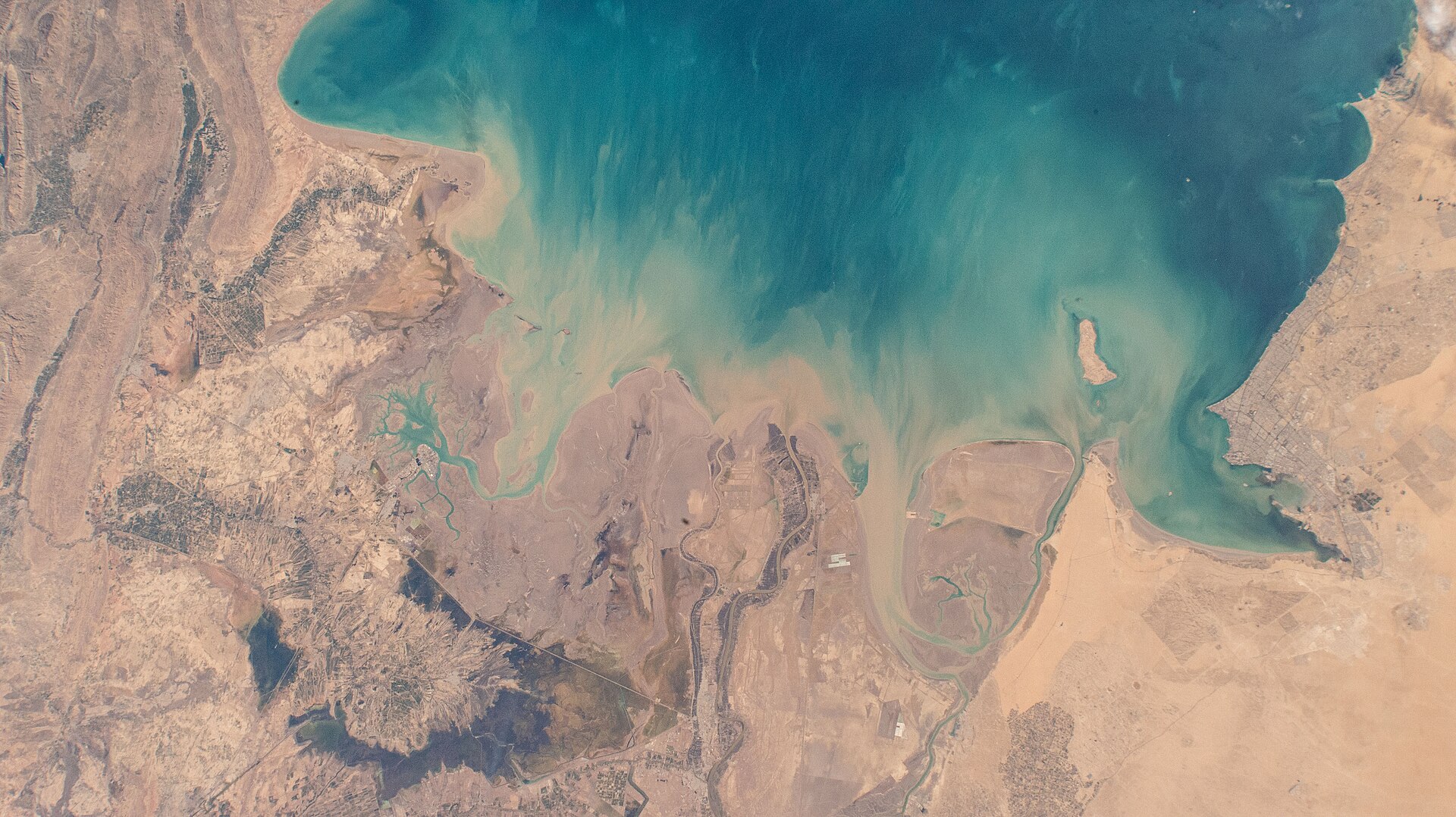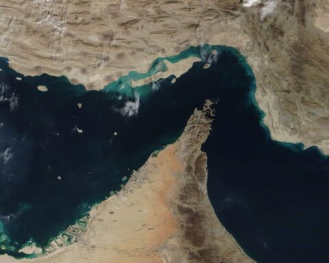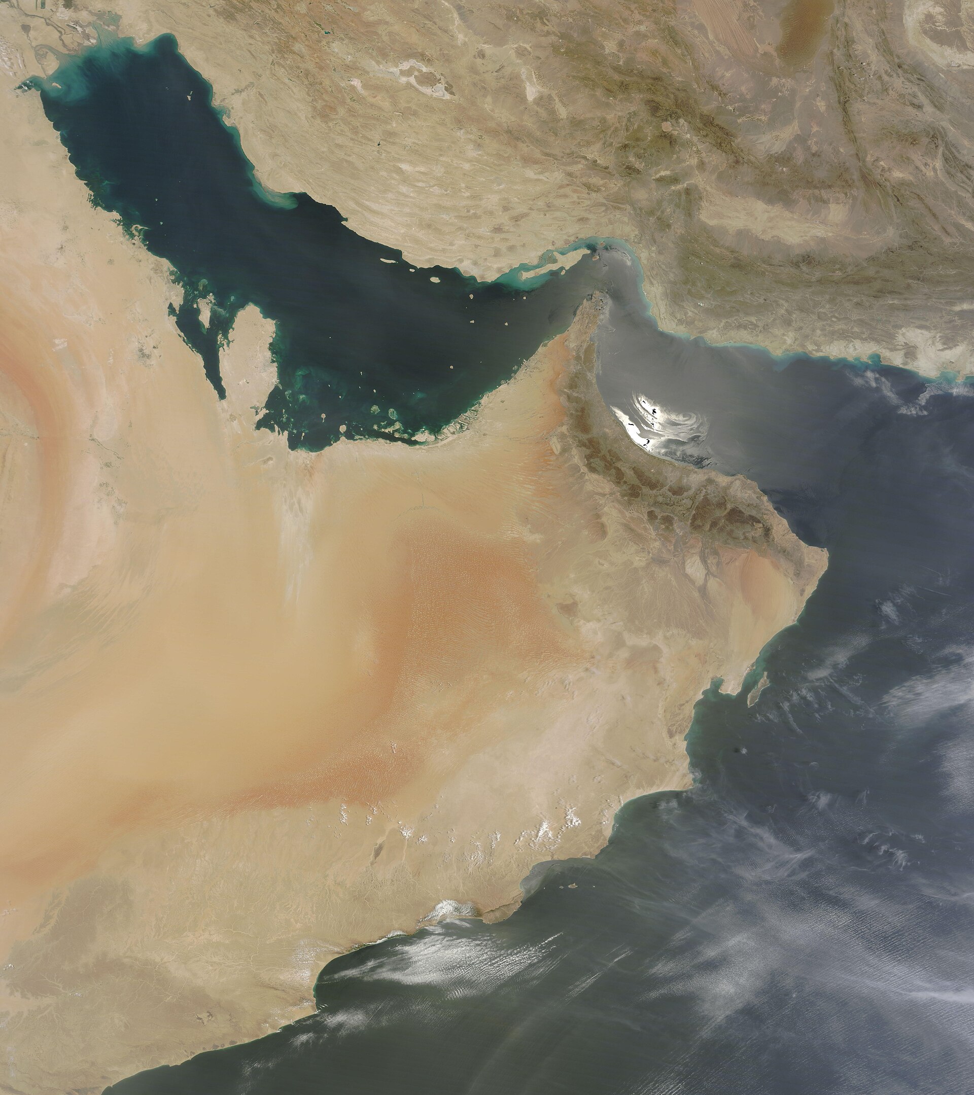
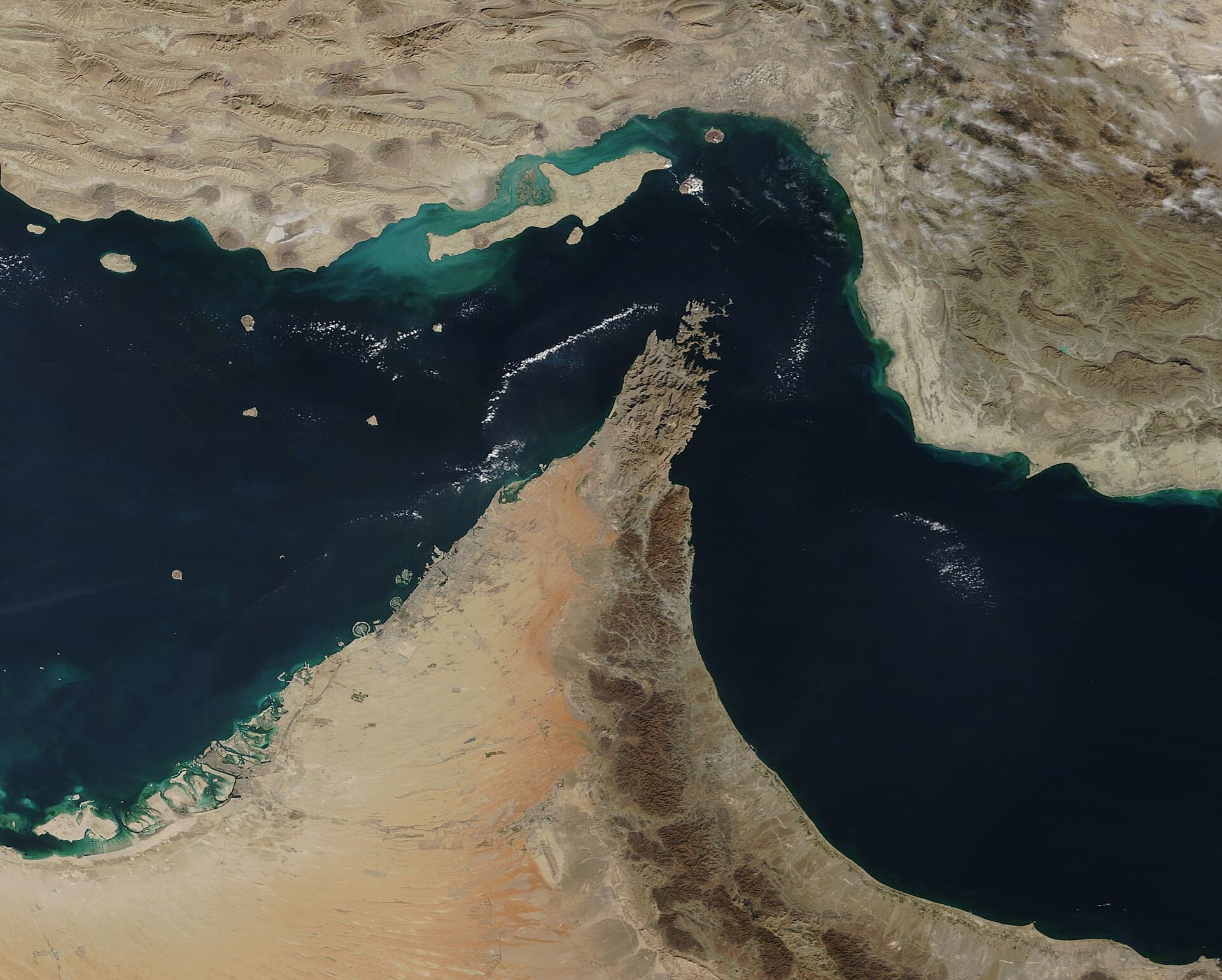
TEHRAN — Iran’s Islamic Revolutionary Guard Corps declared a 500-kilometer operational crescent on May 12, stretching from Jask in the Gulf of Oman to Siri Island in the Persian Gulf. IRGC Rear Admiral Mohammad Akbarzadeh, deputy political director of the IRGC Navy, announced the expansion in statements carried by Tasnim, Fars, and PressTV. “The Strait of Hormuz has grown larger and has turned into a vast operational area,” Akbarzadeh said, according to Argus Media.
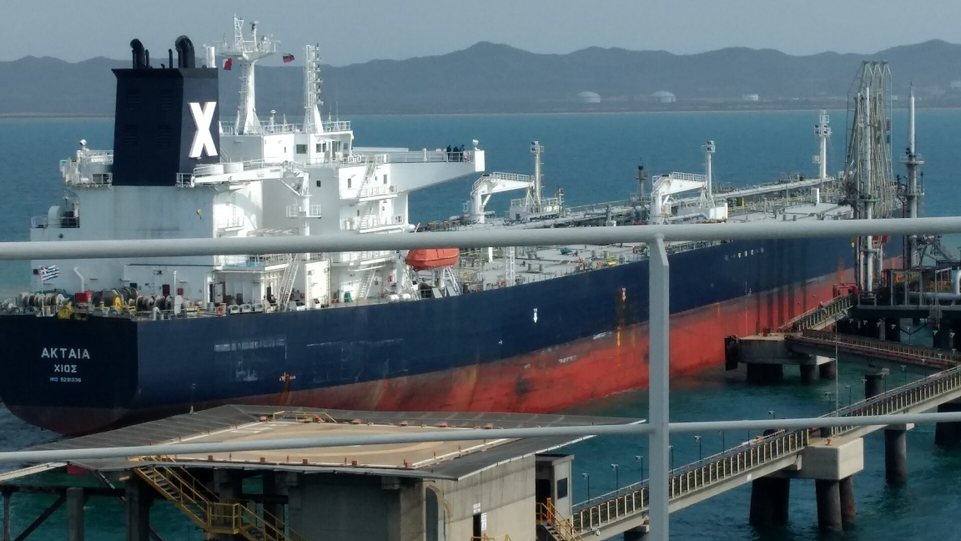
Jask sits outside the strait. It lies in open Gulf of Oman water, where UNCLOS transit passage provisions do not apply and where no coastal state may control foreign-flagged shipping beyond its 12-nautical-mile territorial sea. Zero commercial ships have transited the strait since the Persian Gulf Strait Authority launched on May 4, according to Lloyd’s List Intelligence. Approximately 1,500 vessels and an estimated 20,000 crew remain in holding patterns across the Persian Gulf.
Contents
The Second Expansion in Eight Days
The May 12 crescent is the second IRGC boundary expansion since the conflict began. The first, announced May 4 alongside the PGSA’s launch, ran from the western tip of Qeshm Island to Umm al-Quwain in the UAE and from Kuh Mobarak to Fujairah. That expansion absorbed the strait’s western approaches. The crescent absorbs its eastern exit.
Akbarzadeh described the zone as encompassing Qeshm Island, Greater Tunb Island, Hormuz Island, and Hengam Island — extending “beyond the large islands, from the coast of Jask to Siri Island.” The War Zone published the most detailed technical breakdown of the expansion. The crescent, its analysis noted, converts the strait from a narrow channel into an arc of claimed sea space spanning both the Persian Gulf and the Gulf of Oman.
“The Strait is no longer viewed as a narrow stretch around a handful of islands but instead has been greatly enlarged in scope and military significance,” Akbarzadeh told IRGC-affiliated media, as reported by Argus Media. “The Islamic Republic of Iran is carefully and authoritatively monitoring all regional movements.”
The Middle East briefing 3,000+ readers start their day with.
One email. Every weekday morning. Free.
The previous operating framework — contested as it was — shared a common geography with the legal regime designed to govern it. Both the IRGC’s enforcement zone and UNCLOS transit passage referred to the same 21-nautical-mile waterway. The crescent discards that overlap. Iran’s military perimeter now covers 200 to 300 nautical miles across waters that fall under three separate UNCLOS regimes: territorial sea, exclusive economic zone, and high seas.
Why Does Jask Change the Legal Argument?
Jask lies in the Gulf of Oman, outside the strait. UNCLOS Part III governs transit through international straits, not open ocean. Waters off Jask fall under EEZ and high seas rules, where coastal states cannot control foreign-flagged vessels beyond the 12-nautical-mile territorial sea. The crescent extends Iran’s military claims into waters where no such authority exists.
The legal architecture for Hormuz rests on UNCLOS Articles 37 through 44. Article 37 defines transit passage as applying to straits “used for international navigation” between the high seas or an exclusive economic zone. Article 38 states that transit passage “shall not be impeded.” Article 42 permits bordering states to designate sea lanes but bars them from conditioning passage on state approval.
Iran signed UNCLOS in 1982 and never ratified it. Tehran’s position, held for four decades, is that transit passage represents a “package deal” among parties — not customary law binding non-signatories. James Kraska of the Naval War College has argued otherwise. “Imposing transit fees is a violation of the rules of transit passage,” Kraska has stated. “There is no legal basis under international law for a coastal state to charge fees in an international strait like Hormuz.”
The Jask extension creates a problem that Kraska’s argument — and every other UNCLOS-based objection — was not built to address. Waters off Jask are not an international strait. The crescent claim there sits closer to an exclusion zone assertion under the San Remo Manual than to a transit passage dispute. Even San Remo treats exclusion zones as temporary wartime measures, not permanent jurisdictional changes.
Safia K. Southey, writing for EJIL Talk in an analysis titled “Codifying Coercion,” identified the deeper shift. Iran’s “stated intention to revise the legal order governing [the strait] on a continuing basis is the more legally significant development,” Southey wrote. The crescent is the second such revision in eight days.
The Forty Questions and Zero Transits
The PGSA, launched May 4 with a 40-question Vessel Information Declaration form, has processed zero voluntary transits since its inception, according to Lloyd’s List Intelligence. Richard Meade of Lloyd’s List described the system as one that “formalizes the structure and appears to be a play by Iran to normalize its authority over transits.”
The 1,500 vessels in holding patterns represent the visible cost. The sanctions trap the PGSA creates for any shipowner who completes the form is the structural one. Filing a declaration to an unrecognized Iranian authority risks triggering secondary sanctions compliance failures under U.S. OFAC rules. Not filing means not transiting.
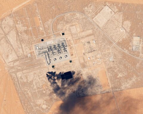
Brent crude closed above $107 per barrel on May 12, according to CNBC. WTI traded above $101. VLCC charter rates remain at an all-time benchmark of $423,736 per day, according to Baltic Exchange data. The Cape of Good Hope reroute adds 3,500 to 4,000 nautical miles and 10 to 14 extra days per voyage. It has become the default for tankers that previously passed through the strait in hours.
Pre-war Hormuz throughput ran at approximately 18 million barrels per day, roughly 21% of global petroleum liquids. The East-West Pipeline to Yanbu carries Saudi crude to the Red Sea but at a ceiling well below pre-war Hormuz volumes. A 92% collapse in tanker transits, measured from pre-war baselines across the full conflict period, separates a workaround from a solution.
What Can the IRGC Enforce Across 500 Kilometers?
The IRGC’s naval inventory is designed for coastal, dispersed, punitive operations — not for administering a 500-kilometer zone as a coast guard would. Iran fields 500 to 1,000 armed fast attack craft, over 1,000 coastal drone assets, and 14 to 20 Ghadir-class midget submarines with mine-laying capability, according to IRGC-published orders of battle and Western defense assessments. Enforcement works through deterrence and automation rather than patrol coverage.
The fast-boat fleet includes the Heydar-110 missile boat, which Iran rates at 110 knots. The larger Fateh-class submarine — 593 tons, 48 meters, 35-day endurance — extends the range of sub-surface operations. Underground tunnel networks that IRGC media calls “vessel cities” house fast-boat formations inside coastal rock, with estimated survivability rates against air strikes that IRGC commanders have claimed exceed 60%. The IRGC released footage of these systems alongside the crescent announcement, as documented by The War Zone.
The question is not whether these assets can sink ships. They can. It is whether they can administer 500 kilometers of crescent — check papers, verify PGSA compliance, selectively permit or deny passage across an area ten times the size of the traditional strait. Administration requires presence at scale. Sinking a ship requires one drone.
The IRGC’s operational answer, visible in the PGSA’s first days and in the mine-laying campaign documented throughout the conflict, has been to make enforcement automatic rather than active. Mines, drones, and the declaration form achieve what a traditional naval force would need hundreds of patrol vessels to replicate. No one moves without asking first.
The Parliamentary Codification
The IRGC crescent operates, for now, as a military declaration. Iran’s parliament is working to make it law. A 12-article bill titled “Law on Establishing Iran’s Sovereignty over the Strait of Hormuz” has cleared the National Security and Foreign Policy Committee. It is heading to the full chamber, according to Iran International and the Washington Times.
The bill’s provisions go beyond the IRGC’s operational language. They include tolls on transiting vessels, confiscation of 20% of cargo from violators, and a blanket bar on Israeli and hostile-state ships. A separate provision requires all official communications to use “Persian Gulf” — aimed at Arab states that use “Arabian Gulf.”
Iran’s five preconditions for resumed nuclear talks include “formal recognition of Iran’s sovereign rights over the Strait of Hormuz.” The demands were circulated through diplomatic channels and reported in the context of broader negotiations. The parliamentary bill creates domestic law. The diplomatic demand seeks international recognition of it. Both tracks advance simultaneously.
Tasnim and Fars — both IRGC-affiliated outlets — argued separately that Iran should impose fees on undersea internet cables passing through the strait, citing UNCLOS Article 34. Article 34 states that the transit passage regime “shall not in other respects affect the legal status of the waters forming such straits.” The IRGC’s own media outlets cited the provision that limits what bordering states may claim.
What Was Discussed in Muscat on May 13?
Iranian and Omani officials met one day after the crescent announcement, with IMO Secretary-General Arsenio Dominguez present. Both sides affirmed their “sovereign rights and jurisdictions over the strait,” framing Hormuz as territorial waters of both countries. This language — if codified — would position transit passage as a privilege subject to bilateral regulation rather than an automatic right.
Iranian Deputy Foreign Minister for International Legal Affairs Abbas Baqerpour led the Iranian delegation. Omani Foreign Minister Badr al-Busaidi hosted. PressTV reported both sides “emphasized their sovereign rights and jurisdictions over the strait, stressing that it is part of the territorial waters of both countries.”
The phrase carries a specific legal claim. The strait at its narrowest measures 21 nautical miles. Iran and Oman each claim 12-nautical-mile territorial seas — 24 miles combined — leaving no international waters in between. If both states maintain that Hormuz consists entirely of sovereign territorial waters, the transit passage regime becomes a concession rather than a right.
Oman has not endorsed the IRGC crescent. It has not condemned it either. Dominguez’s presence — the IMO has struggled to assert institutional authority over the Hormuz crisis since February — gave the meeting multilateral framing without multilateral substance.
Background
During the 1980-88 Tanker War, Iran and Iraq attacked more than 190 commercial vessels over eight years. Both sides targeted tankers, both sides used mines, and both accepted retaliation as a cost. Neither government declared a permanent operational zone of any size. The strait remained dangerous and open.
The current crescent exceeds anything from that war. It also exceeds the double blockade framework that emerged on April 13. Under that arrangement, the U.S. controls the Arabian Sea entry while the IRGC controls the Gulf of Oman exit. The crescent absorbs the IRGC’s half and extends it hundreds of nautical miles deeper into the Persian Gulf.
Iran’s previous Hormuz posture — enforced through the PGSA, selective seizures, and the Jask claim — operated within geographic boundaries that both sides had treated as the strait for decades. The crescent rewrites the map.
Frequently Asked Questions
What is the Goreh-Jask pipeline and how does the crescent affect it?
The Goreh-Jask pipeline runs approximately 1,000 kilometers from Goreh in Bushehr province to a terminal at Jask. It currently operates at roughly 300,000 barrels per day, with a design capacity of one million bpd. Iran built it to bypass the Strait of Hormuz for its own crude exports. The crescent now encompasses both ends of this bypass — Siri Island at the western anchor and Jask at the eastern. Iran’s own Hormuz workaround terminal sits inside the military zone it declared over the waterway the pipeline was built to avoid.
Has any country declared a maritime exclusion zone this large?
The closest parallel is the United Kingdom’s 200-nautical-mile Total Exclusion Zone around the Falkland Islands in 1982. It was declared during active combat and revoked when fighting ended. Argentina declared a similar zone. Both were explicitly temporary wartime measures. Iran’s crescent — paired with a 12-article parliamentary bill seeking permanent codification — would be the first permanent exclusion zone of this scale over an active international shipping lane. No belligerent during the 1980-88 Tanker War declared a zone remotely comparable.
How are PGSA transit fees collected?
According to Safia K. Southey’s analysis in EJIL Talk, the PGSA collects approximately $2 million per transit in yuan and cryptocurrency. Payments bypass SWIFT, processed through financial channels established during the pre-war sanctions era. Vessels linked to the United States or Israel are barred entirely — no fee grants passage. With zero transits recorded since May 4, according to Lloyd’s List Intelligence, the fee structure has functioned as a deterrent rather than a revenue mechanism.
Could Oman legally challenge Iran’s crescent?
Oman shares jurisdiction over the strait’s southern shore and maintains its own 12-nautical-mile territorial sea claim. The crescent extends east into the Gulf of Oman, where Omani EEZ claims overlap with Iranian ones. Oman could invoke the International Tribunal for the Law of the Sea or an Annex VII arbitral tribunal under UNCLOS — mechanisms it has never used against Iran. The May 13 Muscat joint statement, emphasizing shared sovereignty, suggests Oman is positioning itself as co-manager rather than challenger.